Weather Lookup

⚠ Active Alerts

Heat Advisory Heat Advisory issued July 29 at 12:31AM EDT until July 29 at 8:00PM EDT by NWS Tallahassee FL

Current Conditions — KABY

82°F Clear
💧 Humidity 79%
💨 Wind 3 mph SW
👁 Visibility 10.0 mi
🌡 Pressure 29.83 inHg

Hourly Forecast — Albany,GA

1:00 AM 81°F Partly Cloudy 💨 5 mph SW
2:00 AM 80°F Partly Cloudy 💨 5 mph SW
3:00 AM 80°F Partly Cloudy 💨 5 mph WSW
4:00 AM 79°F Partly Cloudy 💨 5 mph WSW
5:00 AM 79°F Partly Cloudy 💨 5 mph WSW
6:00 AM 79°F Mostly Sunny 💨 5 mph WSW
7:00 AM 78°F Mostly Sunny 💨 5 mph WSW
8:00 AM 80°F Sunny 💨 5 mph WSW
9:00 AM 83°F Mostly Sunny 💨 5 mph W
10:00 AM 88°F Mostly Sunny 💨 5 mph W
11:00 AM 90°F Mostly Sunny 💨 5 mph W
12:00 PM 93°F Partly Sunny 💨 5 mph W
1:00 PM 96°F Partly Sunny 💨 10 mph W
2:00 PM 97°F Partly Sunny 💨 10 mph WNW
3:00 PM 97°F Slight Chance Showers And Thunderstorms 💨 10 mph W
4:00 PM 98°F Chance Showers And Thunderstorms 💨 10 mph W
5:00 PM 97°F Chance Showers And Thunderstorms 💨 10 mph NW
6:00 PM 96°F Chance Showers And Thunderstorms 💨 10 mph W
7:00 PM 93°F Chance Showers And Thunderstorms 💨 5 mph W
8:00 PM 89°F Chance Showers And Thunderstorms 💨 5 mph W
9:00 PM 85°F Slight Chance Showers And Thunderstorms 💨 5 mph W
10:00 PM 82°F Partly Cloudy 💨 5 mph W
11:00 PM 81°F Partly Cloudy 💨 5 mph W
12:00 AM 80°F Partly Cloudy 💨 0 mph

Daily Forecast — Albany,GA

Overnight 78°F Partly Cloudy 💨 5 mph SW
Wednesday 99°F Mostly Sunny then Chance Showers And Thunderstorms 💨 5 to 10 mph W
Wednesday Night 75°F Chance Showers And Thunderstorms 💨 0 to 10 mph W
Thursday 95°F Sunny 💨 0 to 5 mph NW
Thursday Night 72°F Mostly Clear 💨 0 to 5 mph W
Friday 95°F Sunny 💨 0 to 5 mph WNW
Friday Night 73°F Partly Cloudy 💨 0 to 5 mph WSW
Saturday 91°F Chance Rain Showers then Chance Showers And Thunderstorms 💨 0 to 5 mph SW
Saturday Night 73°F Chance Showers And Thunderstorms 💨 5 mph SW
Sunday 87°F Showers And Thunderstorms 💨 5 to 10 mph SSW
Sunday Night 73°F Showers And Thunderstorms then Chance Showers And Thunderstorms 💨 0 to 10 mph SSW
Monday 88°F Chance Showers And Thunderstorms 💨 5 to 10 mph SSW
Monday Night 73°F Showers And Thunderstorms Likely then Mostly Cloudy 💨 0 to 5 mph SSW
Tuesday 92°F Chance Showers And Thunderstorms 💨 0 to 5 mph SW

🚗 Road Conditions

Good

Nearest monitored road: North Jefferson Street (Primary)

1:45 AM Good
2:00 AM Good
2:15 AM Good
2:30 AM Good
2:45 AM Good
3:00 AM Good
4:00 AM Good
5:00 AM Good

Forecast Discussion — TAE

View Full Discussion on NOAA →

Key Messages

Issued at 849 PM EDT tue jul 28 2026

- hazardous heat is expected again for wednesday. A heat advisory remains in effect for heat index ranging from 108-112f. There is a 30 to 50 percent chance that extreme heat (heat indices above 113f) develops across florida big bend and panhandle on wednesday. Those vulnerable to the heat should take precautions, such as hydrating and taking frequent breaks.

- strong to severe thunderstorms are likely on wednesday afternoon and evening. There is a slight risk (level 2 of 5) over portions of southwest ga and the fl big bend, and a marginal (level 1 of 5) across the remainder of the region. The primary threats will be damaging wind gusts, in addition to prolific lightning.

Short Term

(this evening through wednesday) issued at 242 PM EDT tue jul 28 2026

The heat continues again on wednesday as the eastern periphery of a ridge axis moves through and an upper level trough and front approach into the evening hours. One of the challenging aspects of today's heat indices was the after effects of a expansive complex of storms that moved through last night. These brought increased clouds and a little bit of drier mid-level air and it has largely prevented US from reaching extreme heat warning criteria so far today. However, with today's convective coverage expected to be less, and a return to deeper moisture tomorrow, guidance has trended higher for heat indices. With widespread values of 108 to 112 forecast now, we have issued another heat advisory for wednesday afternoon area-wide. There remains a low (10 to 30%) chance that extreme heat warning level indices develop across the panhandle and florida big bend, but due to some uncertainties in upper level cloud cover in the morning and timing of convection on wednesday we have held off for now.

After a hot afternoon, our concerns then turn to development of widespread strong thunderstorms as the trough axis drops into the region and provides additional upper level support. With deeply mixed low levels underneath ample instability and high precipitable waters, we're likely to see a very favorable wet- microburst environment in place across the area. Forecast dcape profiles of 1000-1500 j/kg across much of the region will support isolated to scattered severe gusts in the strongest storms. Additionally, as storm outflows converge a more organized complex of storms could develop through the evening as storms drift northwest to southeast. With this in mind there is currently a slight (level 2 of 5) risk for severe storms wednesday afternoon into the evening. Storms will likely continue well into the evening before activity slowly wanes as the trough axis pushes south, but we wouldn't be surprised for some activity to continue past midnight.

Long Term

(wednesday night through next monday) issued at 242 PM EDT tue jul 28 2026

The heat will slowly abate thursday and into next week as a progressive pattern sets up across the US. From a conus-wide view, a large upper level ridge will prevail across the western US while a persistent trough prevails over the eastern US. This persistent trough over the US, and several disturbances rotating through it, will lead to a cooler and wetter pattern into the weekend as several fronts/boundaries drop south. However, one thing to watch will be the potential for these fronts to stall across the deep south. 90th percentile precipitation amounts into next week reach 8 inches in some locations across the southeast florida big bend (i.E. Reasonable worst case scenarios).

Regardless of the specifics, confidence remains high that we'll be taking a break from the heat by the end of the week. However, if you have outdoor plans late this week and into the weekend, keep an eye out for a wetter pattern developing. Some flooding concerns could also develop, and WPC has outlined some locations across the deep south in a marginal risk of excessive rainfall by the end of week and upcoming weekend.

Aviation

(00Z tafs) issued at 721 PM EDT tue jul 28 2026

VFR conditions are generally forecast to prevail outside of showers and thunderstorms forecast wednesday afternoon with light to moderate westerly winds. Have included prob30 groups at all taf sites for wednesday afternoon to cover the potential for showers and thunderstorms; timing and confidence of the thunderstorms will be refined in future taf packages.

Marine

Issued at 242 PM EDT tue jul 28 2026

The main concerns through the next 36 hours will be wednesday afternoon and evening as a complex of thunderstorms with gusty outflow boundaries is expected to move across the waters from the north. Keep an eye to the sky and monitor radar so you can be ready to head to port if threatening weather approaches. Moderate west/southwest winds, around 15 knots, and 2 to 3 feet seas will prevail through the next two days before winds and seas increase slightly into the weekend as a frontal boundary drops south. These conditions could lead to cautionary levels by thursday that would last into the weekend. Main concerns rain-wise will be a stormy pattern developing, especially from thursday onwards.

Fire Weather

Issued at 242 PM EDT tue jul 28 2026

Hazardous heat continues again on wednesday with heat indicies potentially being hotter as greater low-level moisture moves in so a heat advisory will likely remain in effect for wednesday. Heat advisories of 105 to 112 are forecast. The seabreeze will make some inland progress again, but will likely remain south of i-10. While overall fire concerns will be low, more widespread shower and storm coverage, including some being severe, is expected on wednesday. These will bring gusty and erratic winds as well as prolific lightning producers. Some gusts in severe storms could approach 60 to 70 MPH. High dispersions are also expected just inland from the gulf coast and north of i-10 on wednesday. Transport winds will be more out of the west and west-northwest on wednesday. A wetter pattern is likely to develop into the weekend, limiting fire concerns, but if the frontal system stalls further south, it's possible some lower end fire concerns could remain across our northern counties in southeast alabama and across central georgia.

Hydrology

Issued at 242 PM EDT tue jul 28 2026

A wetter pattern is in store wednesday through at least this weekend as a front moving south through the region is expected to stall. WPC has highlighted the region in a marginal (level 1 of 4) risk for excessive rainfall. The main concern is minor flooding of areas of poor drainage, but isolated flash flooding cannot be ruled out eventually. There are no riverine flooding concerns at this time, but keep an eye out for updated forecasts incase future rainfall amounts change upwards.

Spotter Information Statement

Spotter activation is not requested. However, spotters are always encouraged to safely report significant weather conditions when they occur by calling the office or tweeting US @nwstallahassee.

Preliminary Point Temps/Pops

Tallahassee 78 98 77 93 / 0 60 50 60 panama city 82 94 80 91 / 0 20 40 60 dothan 77 98 75 93 / 0 30 40 50 albany 77 98 75 95 / 0 40 30 10 valdosta 77 98 75 95 / 0 50 40 40 cross city 78 94 77 92 / 0 30 60 70 apalachicola 82 93 80 90 / 0 20 40 60

Radar — KEOX

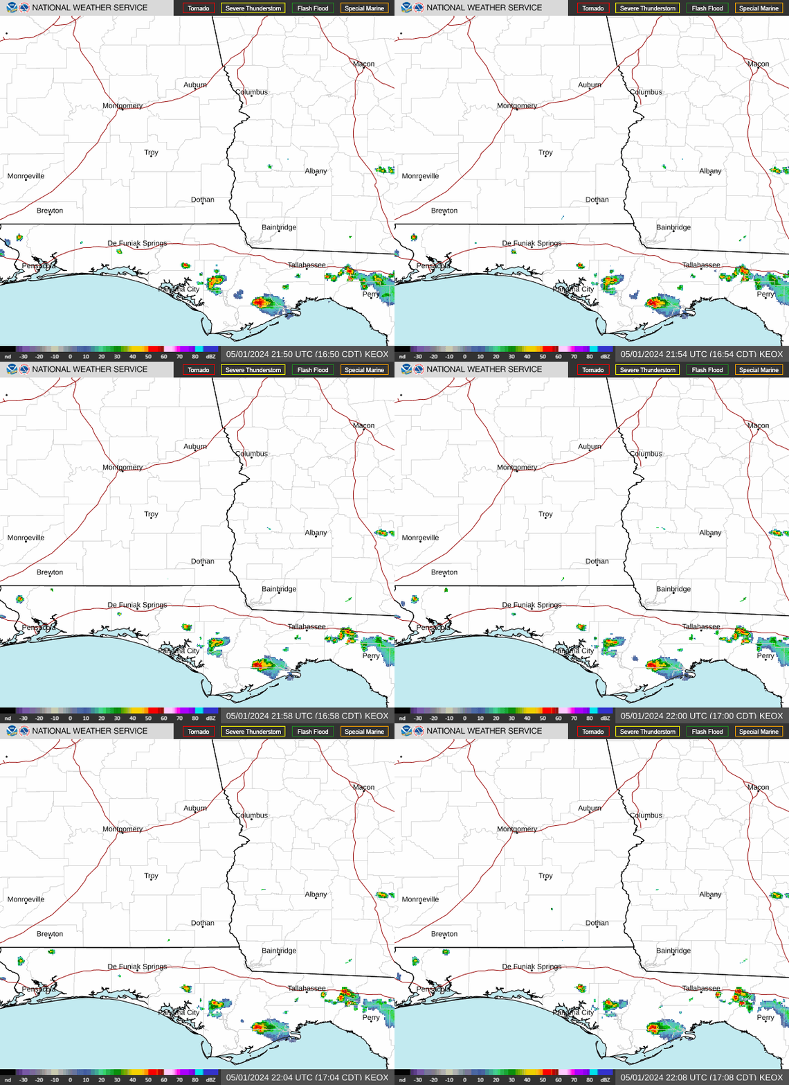
Radar loop for KEOX

Surface Analysis — Eastern U.S. (South)
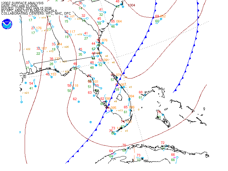
Surface map for Eastern U.S. (South)

Satellite

Satellite imagery
Expanded view