Radar — KMAX
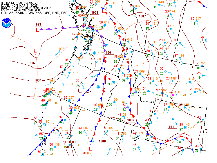
Surface Analysis — Western U.S. (North)
Satellite

Log in to save this location.
Nearest monitored road: Lithia Way (Primary)
16/18Z tafs...VFR conditions prevail for most areas this morning, with some isolated showers lingering east of the winter ridge. MVFR ceilings in the umpqua basin will gradually clear to VFR by early afternoon. VFR conditions will prevail through the evening, with increasing cloud cover expected this afternoon for inland areas. Scattered showers and thunderstorms are expected to develop this afternoon and evening across most inland areas, except for low chances (10%) for storms in the umpqua basin to the north coast. Strong, gusty outflows are possible with any thunderstorms. LIFR/IFR returns to the coast later tonight. -spilde/br-y
/issued 441 AM PDT wed sep 16 2026/
Key messages...
* below normal temperatures for most inland areas today/thursday with some showers and thunderstorms. Main risks are lightning and gusty erratic outflow winds with thunderstorms, especially during the afternoons/evenings.
* temperatures rebound closer to normal friday with warm, dry conditions expected this weekend (above normal).
* relatively low impact weather continues early next week with slight cooling over the interior, nightly marine stratus intrusions north of CAPE blanco, but also possible warming offshore winds along the south coast.
Discussion...a vigorous short wave diving south-southeastward into oregon and norcal is forming an upper level closed low almost directly overhead early this morning. Where forcing and available moisture has been greatest (just to the east of the low's pivot point), this system produced an area of showers and thunderstorms last evening and overnight, especially from north- central siskiyou county up into klamath county, just east of the cascades and some are even breaking out across modoc early this morning. Rain amounts have been mostly around 0.10 of an inch or less, but a few areas have seen wetting rainfall with up to 0.47 at klamath marsh raws. There still have been a few lightning flashes into the early morning hours, but do expect these to be mostly just showers during the morning.
Since the low is cutting off from the main flow aloft, it will just hang out in NW california today. Models continue to show decent instability (by our area's standards) with mucape of 200-400 j/kg beneath the cold core aloft. As a result, we'll see showers and also some thunderstorms redevelop first in the norcal mountains and then extend into SW oregon. Best area of instability will be from siskiyou county up across the cascades this afternoon (could also impact klamath basin) and then over to the west side by this evening. With cyclonic flow around the low, this will result in storm motions from SSE to WNW, but probably not too fast (10-15 KT or so), so they should be wet with pws approaching or exceeding 0.75". Models are showing some decent dcape of around 750-1000 j/kg, along with inverted-v soundings, indicating potentially gusty outflow winds 40+ MPH in the stronger cells. In areas that don't receive much rainfall, there is some concern for potential fire starts. This seems most likely in portions of norcal (esp siskiyou county) where fuels are drier, at least comparatively speaking to areas farther north, where rainfall was greater during the first week of september. Main hours of concern for thunderstorms is between 2 and 8 PM, so this may impact outdoor activities planned for this afternoon/evening. Be sure to seek shelter if you see lightning or hear thunder.
By this evening, instability will wane and thunderstorms should mostly diminish to showers. The closed low will meander across norcal eventually swinging across NE california thursday and into eastern oregon/NW nevada thursday night. This will keep the cooler than normal air mass over our area along with additional showers and thunderstorms. It still appears the highest chances for precipitation will be near and east of the cascades, but with some precip potential on the west side again from eastern douglas county into jackson, southeast josephine and western siskiyou county.
Back side showers could continue into friday morning over the far east side, but we'll see drier air and upper ridging return elsewhere friday resulting in temperatures getting back closer to normal values. An upper ridge should then move into the area this weekend with temperatures returning to above normal. Highs in the 80S and low 90S will be common for west side valleys and in the upper 70S to low 80S over the east side.
It looks like a dry pattern will continue into early next week (rain chances 10% or less area wide), but with only moderate confidence in how that evolves. Models show a closed low meandering offshore of the sf bay area this weekend, eventually moving onshore near or just south of there sunday night into monday (too far south for much moisture to get this far north) with a trough swinging by to our north early next week. That could lead to some cooling over the interior monday or tuesday. -spilde
Marine...updated 230 AM PDT wednesday, september 16, 2026...gusty north winds and steep seas will continue today and tonight. Steep seas could linger into thursday morning, though should subside into friday. We expect north winds to increase again this weekend, with steep, hazardous seas possible again saturday night into early next week. -spilde
None.
Pacific coastal waters...small craft advisory until 5 AM PDT thursday for pzz350-356-370-376.