Radar — KFSD

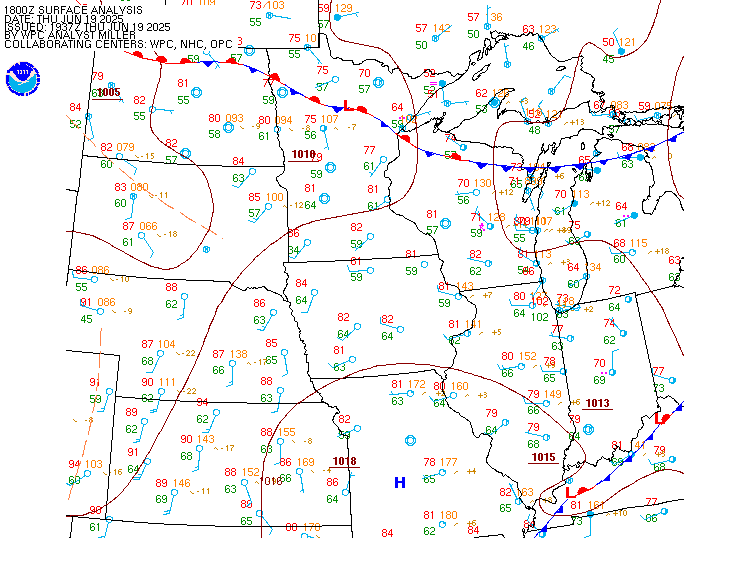
Surface Analysis — Central U.S. (North)
Satellite

Log in to save this location.
Nearest monitored road: US-14 (Primary)
- scattered showers, sprinkles, and drizzle remain on track to develop this afternoon into the evening. Any rain that does reach the surface will be light at 0.1 inches or less.
- fog looks to develop tonight mainly across the buffalo ridge in southwest minnesota, down through northwest iowa, and into the missouri river valley. The fog could be locally dense, so be prepared for potential reductions in visibility.
- confidence continues to increase in beneficial rainfall overspreading the area thursday night through friday morning. The rain could be heavy, especially within a heavier band that develops. Minor impacts to rivers and stream are possible along with ponding in poor drainage areas.
- near normal temperatures persist this weekend and into next week. Any precipitation chances are most likely (30-70%) to remain light and non-severe through the weekend and into next week.
Issued at 243 PM CDT wed sep 16 2026
We are starting to see sprinkles to very light showers break out across parts of the area this afternoon as warm air advection (waa) strengthens aloft. With saturation in the low levels but a dry dendritic growth zone (dgz), sprinkles/drizzle is expected. At the same time, low level stratus not only continues to blanket most of the forecast area but is lowering in height. These conditions will persist through the rest of the afternoon and evening hours before rain chances ending after midnight. Though with lowering ceilings, sprinkles/drizzle looks to persist through the night. At the same time, with sufficient low level moisture in place, ceilings look to lower to potentially down to fog across the area. As of now, think that it is mainly across the higher elevation areas along the buffalo ridge in southwest minnesota, downs through northwest iowa, and along the missouri river valley. With the stratus/fog in place, temperatures will not move much, only lowering to the 50S to low 60S.
Fog along with sprinkles/drizzle will continue into the morning hours before lifting through the morning hours. This should allow for temperatures to warm to the 70S for the afternoon hours. While the afternoon hours will be quiet, things will change thursday evening and especially for thursday night as a shortwave trough rounds the western flank of an upper level ridge, parked over the southern conus. This wave will strengthen low level waa and begin to develop showers across central south dakota thursday evening. The waa will be driven by the low level jet (llj), tightening the temperature gradient, resulting in frontogenesis (fgen). This band of fgen looks to be the main driver for rain as the rain becomes more widespread as the forcing for ascent increases. There also looks to be instability above the front which looks to result in a tighter band of rain. This tighter band of rain continues to look most likely near and north of highway-14. The best forcing for ascent will push off to the northeast of the area friday morning, resulting in slowly waning rain across the area. Could still see lighter rain persist through the rest of the morning hours. There remains some uncertainty in where this heaviest band sets up. Latest 12Z deterministic guidance shows a slight wobble back southwards from the previous 00Z guidance. However, the ensembles show similar placement with this band near and north of highway-14. The ensembles mean QPF remains a broad 0.5 inches to up to about 2.0 inches but their 90th percentile QPF also remains up to 2.0 to 3.0+ inches. Think this 90th percentile is representative of the highest amounts that fall within the band itself. The ensembles probabilities do support these totals as they all have a near 100% chance for 0.50 inches or more of rain. The probability for an inch or more is between 40-90% and lowers to a 20-40% chance for 2 inches or more. Have slightly trended total QPF upwards and think the overall rainfall amounts will be a broad 0.5 inch to 2.0 inches of rain across the area. Locally higher amounts up to and exceeding 3.0 inches is possible, mainly under the band itself. This may lead to minor rises in rivers and streams as well all ponding on roadways and poor drainage areas.
A small break in the action is possible for part of the afternoon hours on friday as some breaks in the clouds occur. This will allow for high temperatures to warm to the low 70S to mid 80S, warmest south of i-90. The pockets of sunshine and diurnal heating may allow for sufficient CAPE values to return northwards, potentially resulting in strong to severe storms. This potential is highly conditional and dependent on how quickly morning showers and cloud cover can exit the area. If a severe weather threat were to materialize, it would be friday afternoon and evening for locations south of i-90.
Saturday looks to be a dry day across the area with high temperatures near seasonable in the upper 60S to low 70S. The break from the rain will be short lived as another upper level wave looks to eject into the plains on sunday. This chance for rain is supported by the ensembles as they show a broad 30-70% chance for rainfall amounts to exceed a tenth of an inch. Good news is that instability is not expected, so this looks to be more stratiform rain rather than convective rain.
Medium range guidance diverges in how the upper level pattern will evolve for next week. There could be additional chances for rain but details are uncertain this far out. Temperatures on the other hand look to remain seasonable in the 60S and 70S.
Issued at 1240 PM CDT wed sep 16 2026
Latest satellite imagery shows stratus and mid level clouds beginning to push into the forecast area early this afternoon. Sprinkles/drizzle/light rain showers are occurring beneath the mid level clouds currently positioned just west of khon. The stratus will continue to push northwards through the rest of the afternoon hours. The stratus will also be lowering the more it pushes into the forecast area, with ceilings expected to fall to MVFR/IFR/LIFR levels throughout the rest of the afternoon but especially the evening timeframe. Sprinkles/drizzle remain possible beneath the stratus through this period of time. With winds going light and variable tonight, the stratus could drop to fog, reducing visibilities down to LIFR levels in the thickest fog. Confidence is highest in fog along the higher elevation areas along the buffalo ridge in southwest minnesota and south central south dakota. In terms of taf sites, have kept mention of fog in ksux's taf. Will keep an eye on potential fog for khon and kfsd. The fog will dissipate through the morning hours, leaving low level stratus to finish out the taf period.