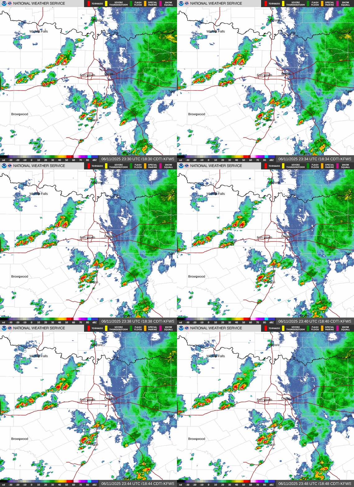
Radar — KFWS
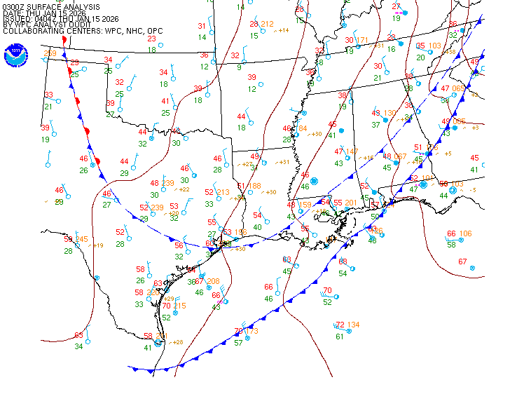
Surface Analysis — Central U.S. (South)
Satellite

Log in to save this location.
Nearest monitored road: North Lamar Street (Secondary)
- areas of fog will be possible across portions of north and central texas late tonight into early sunday morning.
- the next storm system is forecast to sweep across the region monday night into tuesday. There is a low risk of severe weather, but details will continue to be refined over the weekend.
- dry and breezy conditions are forecast tuesday after the showers and storms move east.
(this evening through sunday night) issued at 130 PM CDT sat oct 31 2026
Mostly cloudy and gloomy conditions will persist the rest of the afternoon with high temperatures in the 70S to near 80 degrees. Outside of some occasional light rain/drizzle across portions of north and east texas, most locations will remain dry the rest of the day. For those looking forward for trick-or-treating this evening, temperatures will drop to the 60S with light winds and dry weather.
As rich low-level moisture lingers across the region, another round of low clouds and/or fog will will develop after midnight tonight. While areas across east texas will have the best chances to see areas of dense fog, low clouds and/or patchy fog may still develop elsewhere through sunday morning. A mid-upper level ridge will briefly take over the pattern on sunday ahead of the next storm system. This will keep our area precipitation free, with clearing skies in the afternoon and highs in the 80S. Quiet weather will continue sunday night with lows staying in the low to mid 60S.
(monday through next friday) issued at 130 PM CDT sat oct 31 2026
The main story of the long-term forecast continues to be the strong upper level system expected to travel across the central u.S early this week bringing our next chance for showers and thunderstorms. Large scale troughing will be dominating the western conus with several waves ejecting eastward during the week. At the surface, medium range guidance is in fairly good agreement placing a cold front/dryline near the tx/ok panhandle monday afternoon, pushing east across our cwa monday night into tuesday. Confidence is increasing that any storms that develop ahead of the boundary will remain north/west of our area through late afternoon, with storm chances increasing across our western counties after 6-7PM monday as both the front and upper wave arrive.
Showers and storms will increase in coverage overnight into tuesday as the front moves across north and central tx. Latest guidance shows the boundary somewhere near the i-35 corridor early tuesday morning and towards east/central texas later in the morning or early afternoon. Most of the activity should exit our region by mid-late afternoon with breezy/cooler weather behind the front.
In terms of severe risk, we continue to watch the potential for a few strong to severe storms monday evening/night mainly across our northwestern counties. While the thermodynamic parameters won't be particularly strong over our area, it could be sufficient for a few storms to produce strong/damaging winds. Additionally, winds in the lower levels will also become favorable for organized convection as the system moves eastward. One feature that is still uncertain at this time is the potential for this risk to extend farther east/south monday night and eventually tuesday. While our current thinking is that the best potential will remain north of our area, it is something we will have to watch as new data arrives and higher resolution guidance begins to resolve these features.
Much drier air will begin to filter in behind the front on tuesday. Breezy northwesterly winds 15-20 MPH gusting to 25 MPH are expected during the afternoon keeping the temperatures in the 60S to lower 70S. Clearing skies will follow as well with quiet and pleasant weather to continue wednesday through the rest of the week. Daytime highs will stay in the low to mid 70S and overnight temperatures in the 40S to low 50S. Another disturbance may travel eastward across the central u.S during the late week period, with most of the precipitation staying north of our area.
(00Z tafs) issued at 700 PM CDT sat oct 31 2026
Ceiling and visibility impacts are expected at all terminals tonight through tomorrow morning -
The recent rain showers have left a residual damp boundary layer in their wake, with mid-60S dewpoints common across the region. The local pressure gradient will continue to lax, resulting in light winds aob 5 KTS --largely ESE becoming calm and variable at times-- through early tomorrow afternoon. Combined with patchy clearing evident via visible imagery, low ceilings and areas of reduced visibility are expected to develop tonight.
2330Z observations continue to report bkn035 ceilings across d10. Expectations are for MVFR ceilings to build in by around 09Z, gradually lowering through sunday morning. Guidance has trended towards IFR/LIFR impacts, prompting the inclusion of prevailing IFR (ovc007) from 11Z to 16Z and tempo LIFR (ovc004) from 11Z to 15Z for periods of those sub-500ft cigs. Impacts will begin east of i-35 and across central texas (act) where slightly better low-level moisture resides, building west thereafter; have kdal and kact seeing impacts an hour earlier. Visibility reductions due to fog remain a bit more uncertain, though enough confidence exists to include 3-4sm vsbys during the early morning hours. Visibility improvement should begin around 16Z, with ceilings lifting to VFR near 18Z.
Spotter activation is not expected at this time.
Dallas-ft. Worth 64 81 66 84 / 0 0 10 10 waco 62 83 65 85 / 0 0 0 0 paris 62 79 63 84 / 10 0 0 0 denton 60 80 63 84 / 0 0 0 10 mckinney 63 80 63 83 / 10 10 0 10 dallas 65 82 67 85 / 0 0 10 0 terrell 63 81 63 84 / 0 0 0 0 corsicana 64 82 66 84 / 0 0 0 0 temple 62 85 65 86 / 0 0 10 0 mineral wells 59 81 63 84 / 0 10 0 20