Radar — KDMX
Surface Analysis — Central U.S. (North)
Satellite

Log in to save this location.
Nearest monitored road: East University Avenue (Secondary)
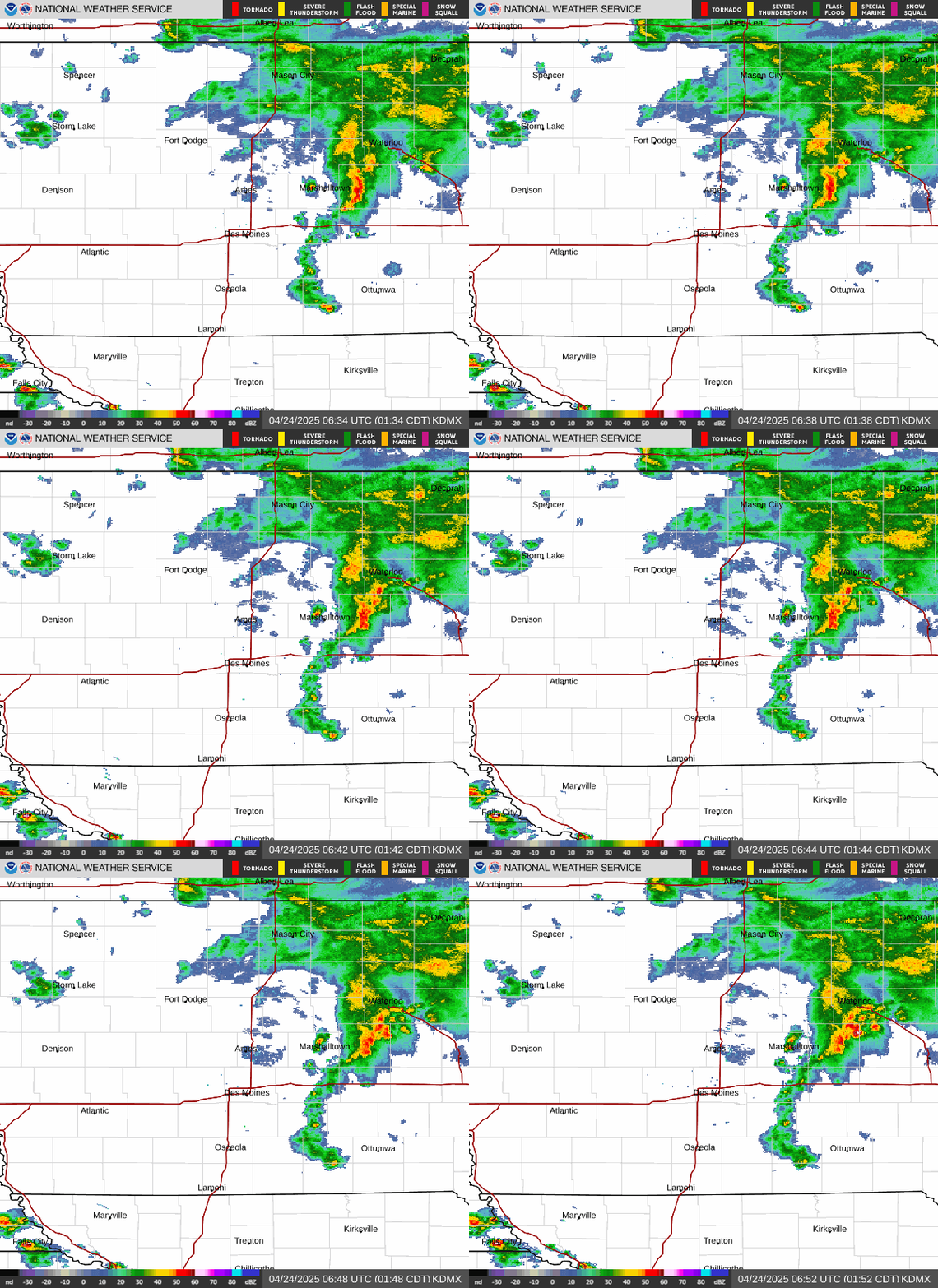
- storms develop late tonight/after midnight with locally heavy rainfall possible. Soils are saturated leaving more susceptibility to flash flooding so flood watch is in effect for areas along and south of highway 30 through thursday morning.
- a break in the rain is expected from late thursday morning through a good portion of the evening before storms return after midnight. Highest rainfall expected over northern iowa.
- scattered storms friday afternoon, but strength and location remains in question. Transition to locally heavy rainfall friday night with highest amounts likely over northern iowa.
- elevated streamflows are more common than not south of highway 30 to the missouri border and will be monitoring for additional rises through the weekend.
- active pattern continues into this weekend with scattered showers and intermittent storms possible, more so saturday than sunday.
Issued at 240 PM CDT wed sep 16 2026
An area of showers continues to lift northeastward, primarily over southern iowa, this afternoon, but rates have been manageable on what is fairly saturated soil. These are expected to continue to fade through the afternoon while sunshine over northern iowa fades behind increasing clouds as low level thermal lift surges back northward. With this surge will come a return of unseasonable to record high precipitable water values for mid- september, deep warm cloud depths supportive of very efficient rainfall processes, and a 850-300mb flow that would favor repeat rounds of rainfall. As the low level jet of around 25 to 30 knots pushes up into this airmass, a band of east to west oriented thunderstorms will develop, likely after midnight. While lapse rates will be weak, instability up to around 1000 j/kg will be possible to aid in storm intensity. There remains some uncertainty in the location of where these storms will develop, but deterministic, ensemble, and ai solutions seem to be converging on somewhere along the i-80 corridor down to the highway 92 corridor. This may end up being mostly east of the des moines metro, but it will be close. In this corridor, rainfall amounts range from 1 to 3 inches with bullseye amounts upwards of 5 inches. The highest rainfall amounts, if they end up east of i-35 and along/south of i-80, is where national water model shows soil saturation around or above 70%. West of i-35 is where soil saturation is above 80%. Thus, while rainfall amounts may be less west of 35, the soil is closer to capacity and it will take less rainfall to have a response toward potential flash flooding. To the east, the higher rates and amounts may push areas toward flash flooding as well. Thus, the flood watch spans most of our highway 30 counties to the missouri border to cover the possible deviations in the placement of the band, but also the sensitivity of saturated soils.
As the low level jet wanes into the daylight hours of thursday morning, so will the storms and showers with a cloudy day forecast from late morning through evening. As the ridge's northern edge noses northwestward on thursday, shortwave energy will lift from the four corners region into the dakotas by friday morning. In conjunction with a strong low level jet of 50 knots pointed into nebraska and strong low level theta-E advection ahead of a warm front, this will cause developed storms to lift northeastward into our forecast area after midnight it not closer to sunrise friday as the jet veers towards iowa. These storms will continue to lift through our area through the morning hours with possible gusty winds, likely below severe limits. Ai solutions for thursday night into friday morning have been trending north with the highest QPF axis likely ending up in eastern south dakota and southern minnesota with a gradient into far northern iowa. This isn't to say farther south in central and less so southern iowa will receive no rain, but that the highest amounts in iowa will be over the northern part of the state.
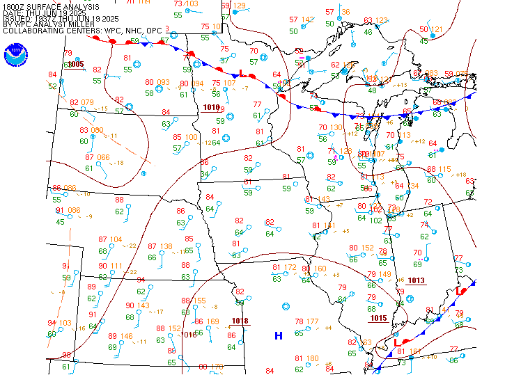
With the aforementioned shortwave energy will also be a surface low pressure that will be near or west of siouxland by afternoon. Friday will be much warmer than recent days with highs into the 70S to low 80S and breezy winds from the south or southeast. Forecast soundings show varied solutions on the amount of capping in the warm sector, which leads to uncertainty in the severe potential. The GFS is less capped with an environment characterized by strong instability above 2000 j/kg and good low and mid-level lapse rates. Low level kinematics are decent around 30 to 35 knots and raise concerns for severe weather for hail and damaging winds, though the turning in the low levels does lead to uncertainty in any rotating storms at this time horizon. The NAM is more clouded in with less instability and thus stronger inhibition, but its wind fields are more concerning in the low levels. Ai and ml severe probabilities are on the lower side, but do show potential in conjunction with the SPC day 3 outlook. Moving into the overnight, the concern will turn to locally heavy rainfall with the best theta-E advection and low level jet support over north central into northeastern iowa and southeastern minnesota where the highest rainfall is currently expected.
Issued at 240 PM CDT wed sep 16 2026
The surface low mentioned above along with a slow moving front looks to slide southeastward into iowa over the weekend as an upper level shortwave pushes over the central and northern rockies onto the plains this weekend. These features will bring the next round of showers and storms with the favorable heavy rainfall environment still over the region more so on saturday than sunday. While there could end up being a few stronger storms, more marginal lapse rates diminish this concern at this time. As the upper level shortwave moves more over the state or immediate vicinity, this will keep shower potential in place into early next week. The intensity, coverage, and duration should be less with time with - i hesitate to type - drier conditions towards wednesday as the influence of surface high pressure moves into the area. This may not be long-lived, but a break would be welcome for those iowans that have seen enough rain.
Issued at 1247 PM CDT wed sep 16 2026
Showers have been lifting slowly northward over southern iowa this afternoon, but will struggle to lift much farther north. Thus, intermittent showers are possible at dsm the next few hours and more widespread at otm until dissipating. Ceilings will lower from south to north with LIFR or IFR conditions common overnight. There may be some spotty showers over northern iowa tonight, which is handled by prob30S, but there will be a band of storms that develop late this evening if not after midnight. This should be somewhere south of alo to near/east of dsm to near/north of otm. Refinement in timing, including possible removal, is possible as trends are monitored. The soupy airmass may also lend itself to fog development overnight. Ceilings will start to trend upward thursday morning, but may not reach MVFR before the end of the period.
Issued at 240 PM CDT tue sep 15 2026
Continued rounds of overnight showers and storms will keep some flash flooding and river flooding concerns in the forecast for the next several days. Training thunderstorms may develop during the overnight tonight with isolated pockets of 2-4 inches possible across central to eastern iowa tonight. Soil moisture is already in the 90th percentile across central portions of the state and a poorly placed band of thunderstorms could be enough to create renewed flash flooding concerns during the overnight, though the threat does not appear to be widespread.
The raccoon river crested this morning and is currently coming down out of minor flood stage. Downstream at the intersection with the des moines river, the stage appears to have turned over already at action stage. Given the multi-day rain chances, concerns for additional crests for these sites and others in central and eastern iowa may continue for several days. In the hefs guidance, the 50% probability (most likely solution) shows many sites with perhaps a 2nd rise with overnight precip, but generally not exceeding the stage it was at today. However, the 30% probability shows rises to action or minor across many central iowa basins (north, middle, raccoon, etc.). So, again, a poorly placed band of thunderstorms tonight could bring some locations to minor flood stage or higher, but the most likely outcome is continued recession.&&