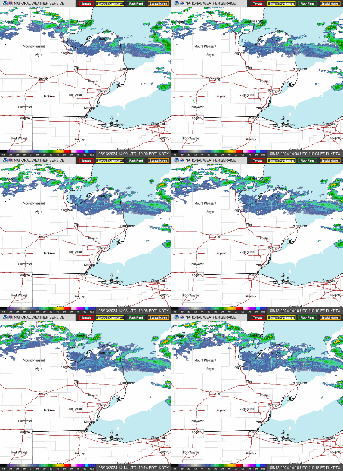
Radar — KDTX
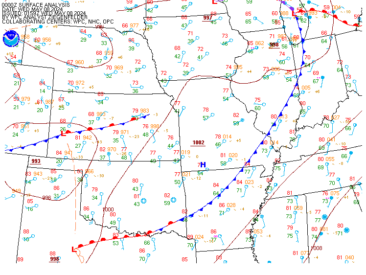
Surface Analysis — Central U.S. (Central)
Satellite

Log in to save this location.
Nearest monitored road: Woodward Avenue (Primary)
- light showers are likely tonight into thursday, primarily south of m-59.
- a short-lived dry period is expected thursday night into friday.
- widespread showers return in earnest saturday into saturday night. Rainfall totals in excess of half an inch are likely, with the potential for 1 inch or more.
A strong upper level ridge (600 dam at 500 mb) will be retrograding west through tennessee over the next day. Deep pseudo-tropical moisture (12Z dtx sounding indicated a very impressive 7 c dew pt at 700 mb) will remain nearly stationary over far southern lower michigan and the ohio river valley. It will not take much forcing to initiate showers, and looks like a series of subtle shortwaves will continue to track out of the midwest and track along/close to the southern michigan border through thursday morning. The forecast is skewed toward higher pops, as euro ensembles indicate a 24 hr QPF of a tenth of an inch or more along and south of m-59 in the tonight- thursday timeframe. Instability looks modest into southern lower michigan with weak mid level lapse rates, while more significant CAPE holds south of border. Thus, any thunderstorms that develop are not expected to be severe, but will serve to enhance rainfall.
As the upper level ridge continues to track westward, the ridge axis will extend into the northern plains, allowing upper level flow to become west-northwest over the central great lakes later thursday. This will support subsidence and a drying-out process as a pronounced surface ridge, extending from strong high over northern ontario, moves in for thursday night and friday.
However, showers will return in earnest for the weekend as low pressure comes out of the central plains and deep pseudo tropical moisture returns. Euro ensembles indicate > 70% chance of half an inch or more or rainfall, with 40-60% chance of one inch or more in the saturday into saturday night timeframe. Uncertainty if there will be another substantial round of showers on sunday or monday, as one last trailing upper level wave moves through, shearing out in the process.
Cooler north-northeasterly flow in place across the central great lakes following this morning's cold front. Winds weaken into tonight and stay on the lighter side (<20KTS) through thursday as the southern edge of northern ontario high pressure slides overhead. The now stalled frontal boundary near the ohio border attempts to lift back north as a warm front saturday as plains low pressure tracks into the great lakes but likely only clears the southern great lakes before the system tracks across lower mi. Widespread showers and scattered thunderstorms are possible, mainly focused over the southern half of the region. A moderate gradient, supporting easterly gusts 20-30KTS, lingers behind the low sunday into the new work week as the area holds between the stalled boundary over the ohio valley and high pressure over northern ontario.
Issued at 1238 PM EDT wed sep 16 2026
Aviation...
An elevated frontal boundary extending across southern michigan will persist through the taf period. A short wave impulse in the mid levels now tracking into SE mi will support scattered to numerous afternoon showers, mainly across the metro detroit terminals. Observations also indicate some IFR ceilings in the far south, closer to the actual surface cold front. Subtle shallow dry air advection from the north has held ceilings primarily MVFR from ptk northward. Recent model soundings and observational trends suggest fluctuations between MVFR and VFR across the north through the afternoon and evening as drier air continues to nudge into the area from the north. An increase in shower chances is forecast overnight as a secondary short wave tracks across far southern lower mi. Available guidance indicates this will result in lowering cloud bases during the overnight and persisting into thurs morning, raising the probabilities for MVFR and some IFR conditions .
D21/dtw convection...any potential for thunderstorms through the rest of today and tonight will remain south of the airspace within the region of better instability.
Dtw threshold probabilities...
* high for ceiling 5000 ft or less today through thursday.