Radar — KEPZ

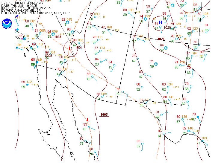
Surface Analysis — Western U.S. (South)
Satellite

Log in to save this location.
Nearest monitored road: North Mesa Street (Primary)
Updated at 1129 AM MDT wed sep 16 2026
- increasing moisture will lead to widespread showers and thunderstorms across southern new mexico and far west texas this afternoon and evening. Main concern will be heavy rainfall and flash flooding. Storm chances will extend well into the nighttime hours tonight.
- flood watch in effect for much of southwest new mexico and the high elevations through 6 AM thursday morning.
- typical mid-september temperatures into the weekend, with lowland highs in the upper 80S to lower 90S.
Issued at 1129 AM MDT wed sep 16 2026
We remain within a moist, active pattern across southern nm and far W. Tx with a subtropical tap on southerly flow. The subtropical ridge, sprawled over the southern plains and SE conus, is driving this flow. Within the southerly flow, wv imagery is showing a weak disturbance/mcv over sonora with speed diffluence over nm and az. One wave is exiting our cwa now, dragging the bulk of our precip with it for the moment, but the moist environment (pw values 1.1" - 1.4"), diffluence aloft, and approaching uv wave is keeping some showers on the radar across southern nm and northern chihuahua. We will see a lull this late morning, but by early afternoon and especially into the evening overnight hours, guidance shows more precip developing/moving in, especially along and west of the rio grande. The current flash flood watch looks good, but we may need extensions (see next paragraph).
The wave over sonora will lift out tonight into tomorrow morning, but we will remain within our moist tap through saturday. This combined with the passage of weak disturbances will keep precip chances alive through then with more rounds of showers and thunderstorms expected. The flash flood watch expires at 6AM thursday, so we will assess the need for any extensions in both time and area. A deeper trough will sweep through saturday, and it will push our moisture east. The devil is in the details though because subsequent thunderstorm development will depend on what happens the day before, so although rain chances prevail through saturday, confidence on individual details is low. Rain chances will end with the passage of the trough, so sunday will be a quieter today as will monday and tuesday. We will also see increasing influence of the ul ridge, further suppressing convection. Our break ends on wednesday with the return of moisture and increasing influence of a closed low to our west, but that is just beyond the forecast window.
(18Z tafs) issued at 1129 AM MDT wed sep 16 2026
Mostly VFR conditions with variable skies. Bases will be as low as 070, lower within shra/tsra. There will continue to be rounds of shra/tsra with higher probabilities across tcs/dmn/lru, especially this later afternoon and evening (after 22Z). The forecast for elp is a bit less certain, but i retained prob30 for the site. Gusty winds and torrential rainfall will be the main impacts with storms. Outside of storms, winds will generally be light, less than 10 knots, and from the SE.
Issued at 1129 AM MDT wed sep 16 2026
We remain within a moist pattern, so there are no fire weather concerns. Afternoon min rh values will range from 25 to 35% with strong overnight recoveries. With the increased moisture, there will be ongoing shower and thunderstorm chances through saturday. Highs will be near or even a few degrees below normal. Winds throughout the period will be light except for gusty winds near thunderstorms. Vent rate categories will range fair to good for today and thursday, decreasing to poor to fair for friday.
El paso 71 94 70 93 / 30 20 40 40 sierra blanca 64 91 64 91 / 10 0 10 0 las cruces 65 90 65 89 / 70 20 40 40 alamogordo 64 91 65 90 / 60 20 30 50 cloudcroft 48 68 49 67 / 60 40 20 70 truth or consequences 66 86 66 85 / 90 30 50 60 silver city 60 81 60 81 / 90 20 50 60 deming 64 90 64 90 / 80 10 40 40 lordsburg 64 86 65 87 / 80 10 40 30 west el paso metro 71 93 71 93 / 30 20 40 40 dell city 66 93 66 94 / 20 0 10 10 fort hancock 71 99 71 99 / 10 10 10 10 loma linda 65 87 65 87 / 30 10 20 30 fabens 70 96 69 96 / 20 10 20 30 santa teresa 68 92 68 91 / 40 10 40 30 white sands hq 70 92 70 91 / 60 20 40 40 jornada range 65 90 66 89 / 70 30 50 50 hatch 66 91 66 90 / 80 20 50 60 columbus 68 92 68 92 / 70 10 40 30 orogrande 65 90 65 89 / 40 20 30 40 mayhill 54 80 54 80 / 60 40 20 80 mescalero 53 79 53 79 / 60 50 20 70 timberon 52 77 53 77 / 50 20 20 60 winston 56 77 55 77 / 90 50 60 80 hillsboro 64 85 65 84 / 90 30 60 60 spaceport 64 88 64 86 / 80 30 50 60 lake roberts 56 80 55 81 / 90 30 60 70 hurley 60 83 60 83 / 90 20 50 50 cliff 63 88 62 88 / 90 30 60 50 mule creek 61 82 61 84 / 100 30 50 40 faywood 63 83 63 82 / 90 20 50 60 animas 64 87 65 88 / 70 10 40 30 hachita 64 87 64 87 / 80 10 50 40 antelope wells 64 88 64 89 / 70 30 40 30 cloverdale 61 84 63 86 / 50 20 40 20