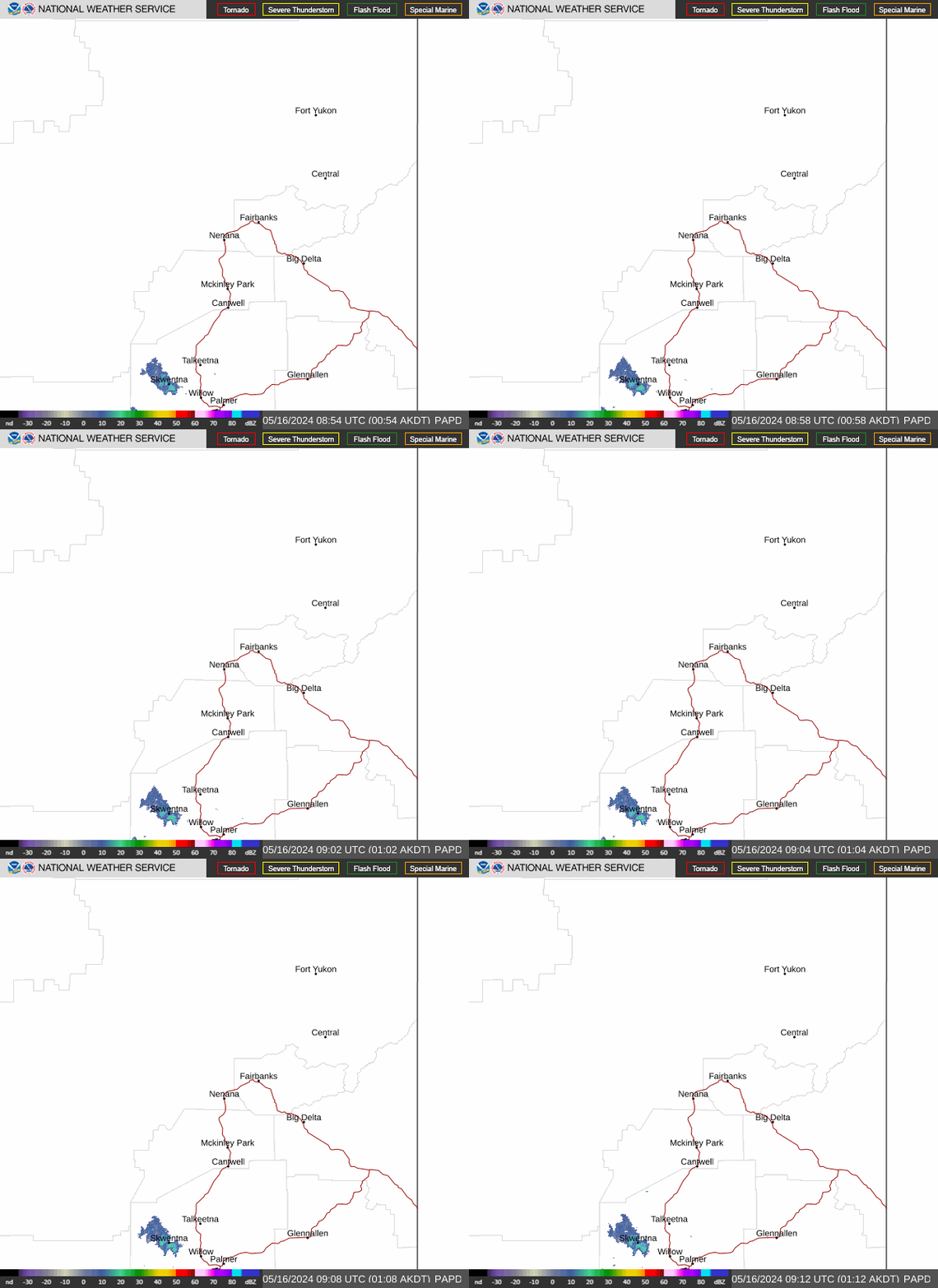
Radar — PAPD
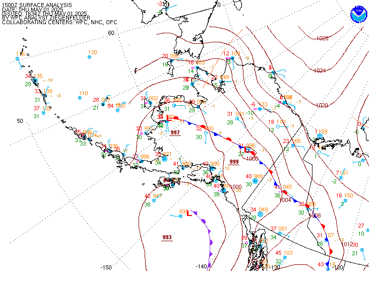
Surface Analysis — Alaska
Satellite

Log in to save this location.
Central and eastern interior... - widespread showers are continuing across the interior as a series of fronts move-in from the west-southwest. Projected rainfall totals through thursday afternoon: (below 1000ft) 0.5" to 1.5" & (above 1000ft) 1.5" to 2.5".
- southwest winds increase across the interior for wednesday. Wind gusts between 30 to 40 MPH are possible through the valleys with higher elevations expected to see gusts between 40 and 45 MPH. A wind advisory remains in effect from wednesday morning to thursday morning.
- a flood watch remains in effect for the chena river basin through the start of the weekend for potential minor flooding.
West coast and western interior...
- gusty winds along the bering strait, yukon delta, & southern western interior will gradually decrease through wednesday.
- moderate-to-heavy rainfall is expected to continue through wednesday morning. Showers are expected to persist thereafter, but the bulk of the rainfall has already fallen.
- additional rainfall expected through thursday night: 0.1" and 0.45" expected along the west coast. Heavier amounts expected further inland with localized amounts up to around 1" possible at higher elevations. A flood watch remains in effect for the upper kuskokwim.
North slope and brooks range... - gusty northeast winds across the NW arctic coast gradually weaken and shift out of the north through wednesday morning.
- the warm front is pushing through the area early this morning, bringing the area some rain/snow showers. The highest snow accumulation totals will be in the brooks range, which may receive a few inches.
- a chance for period of light freezing rain/drizzle is possible across the arctic plains and central & eastern arctic coast from now through wednesday morning. A special weather statement has been issued.
- isolated to scattered snow showers are expected to continue across the north slope through the end of the week.
An impactful 990mb bering sea low & associated cold front is in the process of riding over a ridge of high pressure centered over the ak gulf, moving east-northeastward. The parent low is currently in the process of coming ashore in the east-central norton sound early wednesday morning. It will rapidly weaken as it moves inland into the interior & the central brooks range through mid-week, bringing impactful moderate-to-heavy rainfall & gusty winds from the west coast to the interior & alaska range, generally from the brooks range, southward. This system still has a good amount of moisture to work with a nice plume associated with it. Enhanced ivt values & precipitable water values continue to push in from west to east from the west coast through the interior generally from the brooks range, southward, through mid-week. The higher elevations will get more precipitation via topographic enhancement, receiving up to around 2-2.5 inches of liquid equivalent precipitation from this system in total. After the low makes landfall, it pushes the aforementioned ridge axis over, breaking it down, & the frontal system system weakens as it pushes eastward through the interior. Right after we are done dealing with our current system, for late in the workweek, a weak 1004mb area of low pressure approaches the yukon delta coast, bringing some rain & enhanced wind & seas to the bering sea cost & yk delta region & moves southward through bristol bay, getting incorporated into another strengthening low in the gulf for the weekend.
Then, we move into a general pattern-shift to an overall troughing- pattern, giving more northwesterly flow, for the rest of the forecast period, which will give US cooler weather & a series of weak shortwave troughs moving over, which may bring chances for some snow showers for some areas, especially for the northern half of our aor & at higher elevations. This pattern-change will shift the steering-flow for the stronger weather systems away from our area & toward the anchorage & juneau areas to the south of US. For the north slope & brooks range, they will be on the relatively drier side of this through midweek after which some shortwaves move-in, bringing chances for some light wintry precipitation with light accumulations with the most accumulations for the northern half of our aor, especially for the brooks range & northward through the rest of the week.
/through friday/...for the north slope, arctic coast, & brooks range. Light precipitation & some enhanced winds move into the rest of that area from the weakening area of low pressure & associated warm front approaching from the south starting lasting into thursday morning. Temperatures will be cold enough for some of the precipitation to be of the frozen variety with generally light accumulations of up to a few inches with the highest accumulations being at higher elevations of the brooks range. Some light freezing rain looks to occur for a few hours through wednesday morning before changing over to snow with the area most likely to see this being around deadhorse due to a warm nose of warmer air overrunning the cold sub-freezing air that will be in place at the sfc. After this system completely weakens, the weather will generally transition to the benign side, once again. A special weather statement is in effect through the morning hours for that freezing rain risk.
For the central & eastern interior, including fairbanks: notably, we have been continuing to watch the streams in the chena river basin around fairbanks following the moderate-to-heavy rainfall that fell in the basin from the atmospheric river that moved through a few days ago & the subsequent light rain showers that the basin received into sunday that brought the river to near action stage from a disturbance pushing overhead. Portions of the chena river & forks off the chena river are expected to remain just shy of bankful until a wednesday night through thursday night timeframe, which is when the basin will appreciably start to feel the effects of the moderate to heavy rainfall that that started on tuesday after a bit of a stream response-lag. The aforementioned system will approach & move through, bringing up to between around 1 to 1.75 inches of rainfall to the chena river basin through mid-week. Thus, the chena river below moose creek dam near fairbanks & the little chena river are anticipated to approach minor flood stage between late thursday night to around midday friday & the cresting thereafter. Therefore, a flood watch has been issued for the chena river basin for the aforementioned timeframe. More about that can be seen in the hydrology section.
The alaska range passes will still experience some gusty conditions with wind gusts of up to around 35-45 MPH into wednesday as that low moves eastward over the ridge of high pressure, creating more of a south to north orientation of the tightened pressure gradient & good enough upper-lvl cold mixing-layer support left to receive gusts of that magnitude. Also, a wind advisory is in effect for areas surrounding fairbanks & it includes the lower elevations, which includes fairbanks proper. The strongest winds are expected to be experienced in the higher terrain areas surrounding fairbanks. These advisories are in effect for the lake minchumina area, the white mountains, high terrain south of the yukon river, & for the lower elevations, including the city of fairbanks from until 4AM thursday for frequent southwest wind gusts up to between 30 & 40 MPH. The wind advisories include the lower elevations around fairbanks due to 925mb model forecast wind speeds being around 45-50KT associated with an approaching jet in the lower levels & frontal forcing & a little bit of caa that look to be just enough to mix those gusty conditions into the lower elevations in town.
For the western interior & bering sea coast, the bering sea low is pushing into the east-central norton sound area, moving east- northeastward this morning. It has been bringing in strong gusty winds & moderate-to-heavy rainfall to the bering sea coast area & into the western interior. This will last through wednesday as it comes ashore & moves inland. As it is coming ashore, the low's track has shifted more eastward, pushing into & through the western interior & brooks range through the mid-week timeframe while precipitously weakening. Due to the prolonged moderate-to-heavy rainfall through midweek associated with this & subsequent light showers thereafter, the kuskokwim river area has also been placed under a flood watch through friday afternoon. The basin could receive around 1 to 2.5 inches of rainfall in total depending on where you are in the river basin, & the river is currently not too far from bankful in mcgrath.
There is also a wind advisory in effect for the lower yukon and innoko valleys, north slopes of the western alaska range, and upper kuskokwim valley for frequent wind gusts of up to around 45 MPH through wednesday afternoon due to the tightened south-to-north pressure gradient as the low pressure system approaches & moves past the area. The strongest winds are expected at higher elevations as not as much upper-level support is necessary for those winds to mix down to those elevations.
Through midweek, the broad area of rain will have solidly extended primarily across most of the interior into the brooks range/north slope in association with the aforementioned low moving inland from the eastern bering sea. Most of the interior will see the potential for between around an additional 0.5 & 1.5 inches of rainfall as the low shifts eastward. In higher elevations of the brooks and alaska ranges, precipitation will likely fall as snow, with a few inches of accumulation possible, & higher terrain, in general, will see more precipitation via topographical enhancement.
A weak 1004mb low approaches the yukon delta coast from the west & dives southward out of our aor & toward bristol bay & the ak peninsula emerging into the gulf of alaska, primarily impacting the anchorage & juneau aors through the weekend. It looks to bring a bit of rain, increased seas, & wind to the general yukon delta coast area, the norton sound, & western interior for wednesday night through the end of the work-week, with a few hundredths to around a tenth of an inch possible on each of thursday and friday, with locally higher amounts up to a few tenths of an inch in higher elevation locations that experience any orographic enhancement in the ak range, but nothing really too impactful. This will also bring some enhanced wind & seas to the bering sea cost & yk delta region. That low will then move southward through bristol bay, getting incorporated into another strengthening low in the gulf for the weekend.
/friday night through tuesday/...overall, for the remainder of the forecast period through the beginning of next week, general troughing with northwest flow & cooler temperatures are in store with shortwaves rotating through the flow around around the aforementioned low in the gulf of alaska, bringing continued increased cloud-cover & isolated to scattered showery precipitation of the frozen & liquid variety, more of the frozen variety for the northern portions, especially from the brooks range, northward, & for upper elevations of the ak range, & more liquid for lower elevations, the interior, & west coast areas. The lower elevations around fairbanks may be cold enough during the overnight hours early next week to receive some light accumulations from some snow showers. Currently, no significant accumulations are expected from the aforementioned showers in any of our zones. Stay tuned as next week draws closer.
Coastal hazard potential...none expected.
For the upper tanana valley / mukluk fire area: there are no major fire weather concerns with high temperatures staying on the cooler side & atmospheric conditions remaining on the moist side with minimum rh values generally remaining around 50% or above through the period. More rain chances move in through the week with another approaching frontal system moving northeastward across the alaska range. Accumulations from that will remain light at up to around 0.2 inches or less as the upper tanana valley area will be generally rain-shadowed by the alaska range.
A storm tracking into the norton sound from the bering is continuing to bring a wide swath of persistent rain showers to portions of western and interior alaska. This will continue into late wednesday and thursday for parts of the interior and the southern slopes of the brooks range. Excessive amounts of rainfall on already saturated soils will continue to be a reason for concern for at least the next 24-36 hours as local rivers and streams will continue to respond to the runoff, even after the bulk of the rainfall has come to an end.
Across western alaska, widespread 24 hour rainfall grand totals of between 1 to 1.75" are expected with some locations potentially seeing 2.25 inches of rainfall in total through wednesday. While the yukon and kuskokwim rivers should be able to manage much of the additional water, smaller streams and rivers that feed these systems could experience some minor flooding over the next few days.
Across the interior, the heavier rainfall will last through wednesday, then the rates diminish through thursday. Below 1000ft, additional rainfall of between 0.25 and 1 inch is possible with higher elevations potentially seeing as much as 1.50 inches of additional rainfall through thursday. Current concerns are for the chena river basin as excessive runoff from projected rainfall could lead to minor flooding of the chena, especially east of fairbanks.
Elsewhere, pooling and ponding of water remains a concern, especially during times of ongoing heavier rainfall. This could pose an additional hazard for motorists throughout the interior.