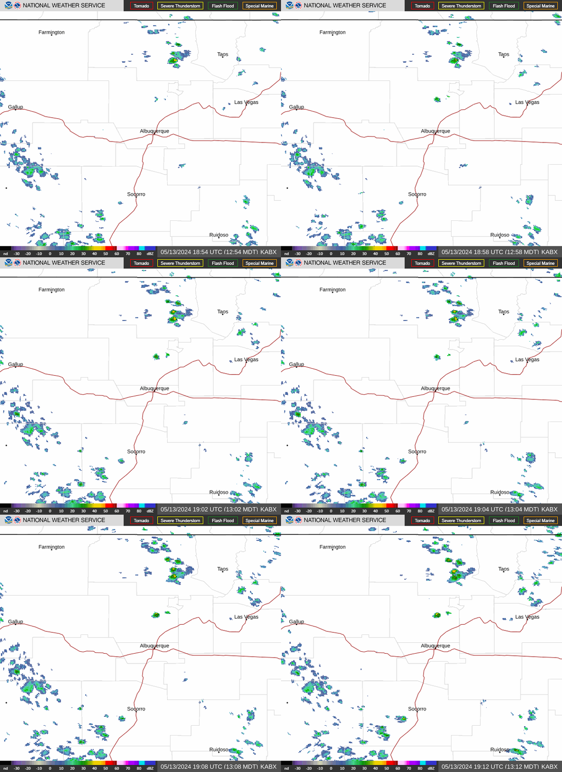
Radar — KABX
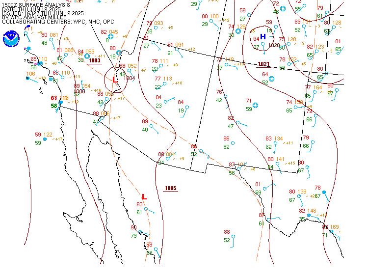
Surface Analysis — Western U.S. (South)
Satellite

Log in to save this location.
Nearest monitored road: West Broadway Street (Primary)
Issued at 217 PM MDT wed sep 16 2026
- a surge of rich monsoon moisture will continue to push into northern and central new mexico this week, increasing the chances for showers and thunderstorms. This will introduce a risk of locally heavy rainfall and flash flooding, especially around urban areas, burn scars, and low water crossings today and thursday.
- water will begin to flow in normally dry arroyos, creeks, streams, and tributaries to mainstem rivers that have dried up this summer. Dirt roads will become muddy, and large areas of standing water may form in low-lying areas.
- isolated strong storms each afternoon and evening this week could produce strong outflow wind gusts, wet microbursts, and small hail.
(this evening through thursday night) issued at 217 PM MDT wed sep 16 2026
A much more traditional monsoon pattern continues over northern and central new mexico as a deep upper low moves toward the northern ca coast, and high pressure remains over the southeastern conus. This is steering a deep plume of subtropical moisture northward into eastern az and western nm where pwats are still exhibiting values in the 97th-100th percentile at 1.0 to 1.3 inches. There were concerns about stability this afternoon, but, so far the northwestern quadrant of the state has had enough pockets of insolation for convective initiation, and portions of the gila and san mateo mountains are also quickly destabilizing. Remnant showers and stratiform rain from nocturnal activity are found between these areas and also over north central zones where it may take longer to destabilize. The flood watch was expanded for today into the frijoles burn scar area, but there are uncertainties for this localized area being impacted again.
The consensus among cams is for precipitation to continue over the western half of nm overnight with a concentration more in the western third of the state. Although precipitation may transition back to more of a stratiform or showery nature, rainfall rates appear to remain high overnight, much like this morning when a quick 1.0 to 2.4 inches fell within 60-120 minutes in ruidoso proper, showing the more tropical nature of cloud droplet distributions. The flood watch will remain intact through thursday morning, and this may need to be extended further.
The flow aloft over nm will turn from due south-to-north to more of a south southwest-to-north northeast direction on thursday as the upper low moves inland. Little change to the pwats is expected into thursday, keeping the western and central mountains favored for new storm initiation by the afternoon. This will be dependent on cloud cover and the ability to destabilize again, but the model consensus indicates this will happen with footprints of heavy QPF of 1 to 2 inches shown in the href probability matched mean. Again, cams have been quite noisy and struggling to pinpoint the localized areas of heavy rain, but we have high confidence in the potential for heavy rain across western and central zones thursday into thursday night. Storms will move quickly to the north northeast at about 20 to 25 MPH, but there will be a continued threat for training cells and a few updrafts anchoring or back- building on south and southwest facing slopes. Storms look to have a difficult time moving into the eastern plains thursday, and with less cloud cover there, temperatures will rise into the upper 80's and 90's (3 to 6 degrees above average) while areas farther west remain near or closer to normal.
(friday through tuesday) issued at 217 PM MDT wed sep 16 2026
On friday, the upper low will be moving into western id while the high shifts into the arklatex region. This will cause a subtle veering in the winds aloft, introducing drier air into far western nm while pushing the best moisture/instability axis over the interior high terrain of the state. Pwats would likely reduce a tenth of an inch or two in central areas, but would still hover around 1.0 inch or slightly more. This would support fewer, but still numerous efficient rain-producing storms with a slight reduction in flash flooding potential friday afternoon. The NAM is a bit of an outlier with less QPF and lower spatial coverage of storms on friday, so it will be interesting to see which solutions get favored with tonight's cam runs. Storms would be more inclined to move into the plains, given the veering steering flow, but may not make it all the way to the ok and tx borders.
More dry air spills into nm from the west on saturday, as the aforementioned upper low shifts toward western wy. While the incoming dry air could reduce the overall heavy rainfall threat in western and central nm, the dry-moist demarcation that will precede the trough axis (extending into the four corners) could prove to be a focal point for strong storm development. Deeper moisture holding on in the south central mountains and east central plains will also fuel scattered storms there saturday afternoon.
The remnants of the low will shift farther east into the northern great plains and weaken on sunday. This will steer a more due westerly wind component aloft into nm with continued drying. Not surprisingly, pwats lower enough to suppress most storm developmentand blended guidance has finally started to reduce advertised pops. The caveat to this will be a backdoor front that may just barely reach union county in northeastern nm. Models have backed off on the invasion of this front for sunday, so low 20-30% pops have been retained in the far northeast to account for this. The front will enter more of northeastern nm sunday night, but appears to largely wash out by monday with surface winds veering mostly south southeasterly over the plains. However, by this time a new pacific low is projected to take shape west of nm. This low could begin to draw a moist east southeasterly return flow into nm monday night with this moisture getting synced up with another monsoon plume to our south. This would lead to a more active storm period tuesday into wednesday of next week with another significant uptick in rainfall and perhaps strong to severe storms.
(18Z tafs) issued at 1153 AM MDT wed sep 16 2026
Batches of rain with a few embedded thunderstorms are moving northward over central new mexico with scattered areas of MVFR ceilings and visibilities where downpours are most prominent. As the afternoon wears on, numerous thunderstorms will develop along the continental divide, western mountains, and central mountain chain, spreading northward into nearby valleys and lower elevations with heavy downpours, lightning, gusty downburst winds, and small hail accompanying. Into the evening hours, many of the storms will congeal into more widespread batches of just general moderate rain that will persist over much of the western half of new mexico through early thursday morning. Additional scattered to widespread areas of MVFR ceilings and visibility will redevelop overnight into thursday morning, especially over the northwestern third or so of the state (kgup, kfmn, kgnt, klam, ksaf, ke33, and kskx).
Issued at 217 PM MDT wed sep 16 2026
Deep monsoon moisture will keep a wet pattern intact for western and central new mexico. While a few stray storms will wander into the eastern plains, their prospects for additional soaking rainfall are not as high as farther west. Locally heavy rainfall will occur in several spots in the western half of the state, bringing much needed fuel moisture, but also posing runoff and flash flooding concerns for some, especially near recent wildfire burn scars. Temperatures have trended near to about 8 degrees below average in the western half of nm, and this trend will continue on thursday before readings modify closer to normal through the weekend. Humidity has trended up with much higher dewpoints, and overnight recoveries will reach 80 to 100% in most areas each morning through the end of the work week. Drier air will slow storm production and reduce rainfall chances just slightly on friday and more-so into saturday with very minimal storm activity forecast by sunday. Storms will start to reappear in northeastern to east central nm by monday and could quickly expand over much of the area again next tuesday and wednesday.
Farmington...................... 58 75 56 80 / 90 90 60 40 dulce........................... 48 73 45 76 / 90 90 90 60 cuba............................ 52 73 50 74 / 90 80 80 70 gallup.......................... 52 73 48 78 / 90 70 50 30 el morro........................ 51 73 48 75 / 90 60 60 70 grants.......................... 53 76 50 78 / 90 80 70 70 quemado......................... 55 76 53 78 / 90 50 60 70 magdalena....................... 58 77 57 77 / 80 40 60 70 datil........................... 54 74 53 75 / 90 50 60 80 reserve......................... 55 78 53 81 / 90 30 50 40 glenwood........................ 59 84 58 86 / 90 30 50 50 chama........................... 49 67 47 70 / 90 90 90 70 los alamos...................... 56 74 56 75 / 80 70 80 70 pecos........................... 53 75 53 76 / 90 70 70 60 cerro/questa.................... 52 72 52 73 / 70 60 90 60 red river....................... 45 64 46 67 / 70 60 80 60 angel fire...................... 40 70 39 70 / 70 60 70 50 taos............................ 51 76 49 76 / 70 60 80 60 mora............................ 51 73 50 76 / 80 70 60 60 espanola........................ 56 81 55 80 / 80 60 80 60 santa fe........................ 57 75 56 76 / 80 70 70 60 santa fe airport................ 56 78 55 78 / 80 70 70 60 albuquerque foothills........... 61 80 61 80 / 80 50 70 60 albuquerque heights............. 62 81 62 81 / 80 40 70 60 albuquerque valley.............. 57 82 56 82 / 80 40 70 60 albuquerque west mesa........... 62 81 61 81 / 80 50 70 60 belen........................... 59 82 59 82 / 80 40 60 60 bernalillo...................... 60 81 59 81 / 80 50 70 60 bosque farms.................... 56 81 56 81 / 80 40 70 60 corrales........................ 60 82 60 81 / 80 50 70 60 los lunas....................... 59 81 59 81 / 80 40 70 60 placitas........................ 60 79 60 79 / 90 50 70 60 rio rancho...................... 61 80 60 79 / 80 50 70 60 socorro......................... 62 82 63 84 / 80 20 40 50 sandia park/cedar crest......... 55 77 55 77 / 90 50 70 70 tijeras......................... 57 79 58 78 / 90 50 70 70 edgewood........................ 53 78 53 78 / 80 50 60 70 moriarty/estancia............... 51 80 51 80 / 70 50 60 70 clines corners.................. 53 77 54 77 / 80 50 60 70 mountainair..................... 55 79 55 79 / 60 40 50 70 gran quivira.................... 56 80 56 79 / 50 30 40 60 carrizozo....................... 60 82 60 82 / 50 40 30 60 ruidoso......................... 55 76 53 78 / 70 60 30 80 capulin......................... 55 77 53 79 / 50 30 20 20 raton........................... 54 80 53 83 / 60 40 30 30 springer........................ 55 83 55 85 / 60 40 30 30 las vegas....................... 53 76 53 78 / 80 60 70 50 clayton......................... 62 86 63 87 / 30 5 10 10 roy............................. 58 80 59 82 / 70 20 20 40 conchas......................... 63 89 63 90 / 50 10 20 40 santa rosa...................... 61 85 62 87 / 60 20 40 60 tucumcari....................... 63 89 65 91 / 40 5 10 30 clovis.......................... 63 89 63 91 / 20 0 10 20 portales........................ 63 90 64 92 / 20 0 5 20 fort sumner..................... 64 89 64 90 / 60 0 20 40 roswell......................... 66 92 66 93 / 30 0 10 20 picacho......................... 59 85 60 86 / 50 30 30 80 elk............................. 57 82 58 83 / 60 30 30 70