Weather Lookup

Current Conditions — KFAT

84°F Clear
💧 Humidity 29%
💨 Wind 9 mph NW
👁 Visibility 10.0 mi
🌡 Pressure 29.82 inHg

Hourly Forecast — Fresno,CA

9:00 PM 88°F Clear 💨 5 mph NW
10:00 PM 84°F Clear 💨 5 mph NW
11:00 PM 81°F Clear 💨 5 mph NW
12:00 AM 79°F Clear 💨 5 mph NW
1:00 AM 76°F Clear 💨 5 mph NW
2:00 AM 74°F Clear 💨 5 mph NW
3:00 AM 72°F Clear 💨 5 mph NW
4:00 AM 69°F Clear 💨 5 mph NW
5:00 AM 68°F Mostly Clear 💨 5 mph NW
6:00 AM 68°F Sunny 💨 5 mph NW
7:00 AM 67°F Sunny 💨 5 mph NW
8:00 AM 70°F Sunny 💨 5 mph NNW
9:00 AM 74°F Sunny 💨 0 mph
10:00 AM 81°F Sunny 💨 0 mph
11:00 AM 85°F Sunny 💨 5 mph WNW
12:00 PM 88°F Sunny 💨 5 mph WNW
1:00 PM 92°F Sunny 💨 5 mph WNW
2:00 PM 96°F Sunny 💨 5 mph WNW
3:00 PM 98°F Sunny 💨 5 mph WNW
4:00 PM 99°F Sunny 💨 5 mph NW
5:00 PM 100°F Sunny 💨 5 mph NW
6:00 PM 99°F Clear 💨 5 mph NW
7:00 PM 98°F Clear 💨 5 mph NW
8:00 PM 95°F Mostly Clear 💨 5 mph NW

Daily Forecast — Fresno,CA

Tonight 66°F Clear 💨 5 mph NW
Wednesday 100°F Sunny 💨 0 to 5 mph NW
Wednesday Night 68°F Mostly Clear 💨 5 mph NW
Thursday 102°F Sunny 💨 5 mph WNW
Thursday Night 69°F Clear 💨 5 mph NW
Friday 104°F Sunny 💨 0 to 5 mph NW
Friday Night 70°F Clear 💨 5 mph NW
Saturday 105°F Sunny 💨 5 to 10 mph NW
Saturday Night 70°F Clear 💨 5 to 10 mph NW
Sunday 104°F Sunny 💨 5 mph NW
Sunday Night 72°F Clear 💨 0 to 5 mph NW
Monday 104°F Sunny 💨 0 to 5 mph WNW
Monday Night 72°F Clear 💨 0 to 5 mph NW
Tuesday 105°F Sunny 💨 0 to 5 mph WNW

🚗 Road Conditions

Good

Nearest monitored road: North First Street (Secondary)

10:45 PM Good
11:00 PM Good
11:15 PM Good
11:30 PM Good
11:45 PM Good
12:00 AM Good
1:00 AM Good
2:00 AM Good

Forecast Discussion — HNX

View Full Discussion on NOAA →

Key Messages

1. High pressure over the region will maintain temperatures near seasonal averages for the remainder of central california today through wednesday, with a warmup commencing thursday.

2. Major heat risk developing thursday for the indian wells valley, mojave slopes and desert, with an extreme heat warning through next monday.

3. Prolonged heat is expected to affect the sj valley this weekend and a heat advisory or extreme heat warning is likely.

4. Seasonably dry conditions to prevail through the week, with no monsoon moisture expected in the mountains. Along with well above normal temperatures, this will produce elevated fire weather concerns late this week into early next week.

Discussion

Temperatures will be near normal through wednesday as an upper ridge remains centered over the southern plains region and weak upper troughing remains centered over northern ca. A fairly benign surface pressure gradient exists such that most of the area will see light winds under 10 MPH, mostly terrain driven. The exception will be over the tehachapi mtns/mojave desert slopes region where near normal WNW wind gusts over 25 MPH will continue.

Starting thursday, the upper ridge begins its slow westward retrograde intro the desert SW while expanding in strength, with 600 dm heights expected by friday over az. By friday, nbm indicates 60-80% probability for valley-wide high temperatures above 105. There is also a similar high probability for high temperatures above 110 across the mojave desert. Combined with low temperatures in the 70S for the valley and 80S for the desert, the weather prediction center places 50-80% probability for major heat risk across the forecast area this weekend and the start of next work week. We have issued an extreme heat warning for the mojave desert, mojave desert slopes and indian wells valley regions through next monday. A heat advisory or extreme heat warning will likely be needed for the weekend for the remainder of the forecast area.

In addition to the increasing temperatures, minimum afternoon rh readings are expected to fall to as low as 5% in the mojave desert and 12-16% in the san joaquin valley thursday through early next week. Increasing mid level warming will lead to progressively poorer overnight rh recoveries especially in higher terrain/mid slope areas. Though winds will remain mostly diurnal and terrain-driven, the combined deep layer of hot and dry conditions with high haines indices will be favorable for fire growth and spread given seasonably dry and cured fuels. Fire weather products may be issued if more aggressive conditions are expected.

The CPC 6-10 day temperature outlook indicates temps will likely remain well above normal, with a 60-70% probability covering much of california as of their latest outlook. The CPC 8-14 day temperature outlook has slightly lower probabilities of well above normal conditions from 50-60%. This falls in line with indications of a more robust monsoon moisture surge developing into the desert region and possibly the southern sierra nevada later next week as the upper ridge shifts further north.

Aviation

VFR conditions will prevail for the next 24 hours.

Air Quality Issues

Unhealthy for sensitive groups in eastern tulare county and sj valley portion of kern county.

Certainty

The level of certainty for days 1 and 2 is high. The level of certainty for days 3 through 7 is medium.

Certainty levels include low...medium...and high. Please visit www.weather.gov/hnx/certainty.html for additional information and/or to provide feedback.

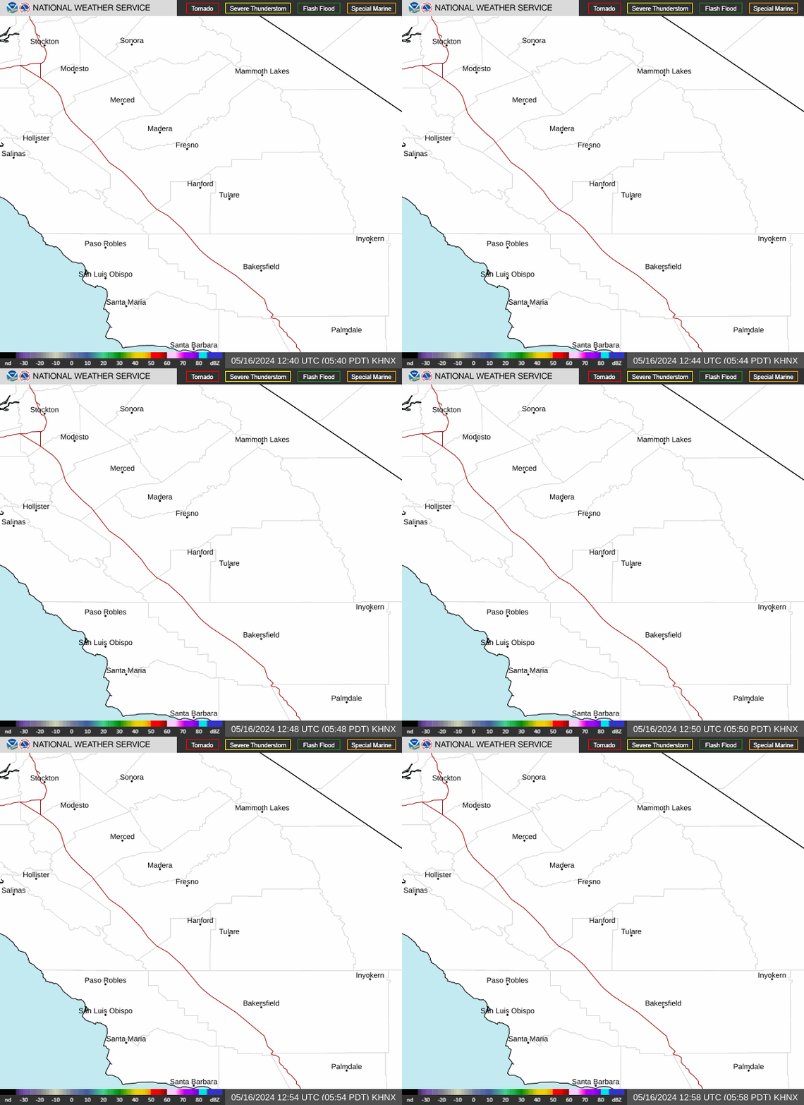
Radar — KHNX

Radar loop for KHNX

Surface Analysis — Western U.S. (South)
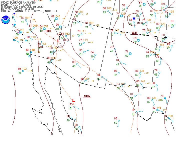
Surface map for Western U.S. (South)

Satellite

Satellite imagery
Expanded view