Weather Lookup

Log in to save this location.

⚠ Active Alerts

Heat Advisory Heat Advisory issued September 16 at 11:30AM CDT until September 16 at 7:00PM CDT by NWS Jackson MS

Current Conditions — KHKS

95°F Clear
Humidity 44%
Wind 7 mph SE
Visibility 10.0 mi
Pressure 30.19 inHg
UV Index 8 · Very High
Air Quality 42 · Good
Sunrise 6:45 AM
Sunset 7:05 PM

Hourly Forecast — Jackson,MS

3:00 PM 96°F Sunny 💨 10 mph ESE
4:00 PM 94°F Sunny 💨 10 mph ESE
5:00 PM 93°F Sunny 💨 10 mph ESE
6:00 PM 92°F Mostly Clear 💨 10 mph ESE
7:00 PM 87°F Mostly Clear 💨 5 mph E
8:00 PM 85°F Mostly Clear 💨 5 mph ESE
9:00 PM 83°F Clear 💨 5 mph ESE
10:00 PM 82°F Clear 💨 5 mph ESE
11:00 PM 80°F Clear 💨 5 mph ESE
12:00 AM 79°F Clear 💨 0 mph
1:00 AM 78°F Clear 💨 0 mph
2:00 AM 78°F Clear 💨 0 mph
3:00 AM 76°F Mostly Clear 💨 0 mph
4:00 AM 75°F Mostly Clear 💨 0 mph
5:00 AM 75°F Mostly Clear 💨 0 mph
6:00 AM 74°F Sunny 💨 0 mph
7:00 AM 73°F Sunny 💨 0 mph
8:00 AM 75°F Sunny 💨 0 mph
9:00 AM 80°F Sunny 💨 5 mph E
10:00 AM 86°F Sunny 💨 5 mph E
11:00 AM 90°F Sunny 💨 5 mph ENE
12:00 PM 92°F Sunny 💨 10 mph ENE
1:00 PM 93°F Sunny 💨 10 mph ENE
2:00 PM 95°F Sunny 💨 10 mph ENE

Daily Forecast — Jackson,MS

This Afternoon 96°F Sunny 💨 10 mph ESE
Tonight 73°F Mostly Clear 💨 0 to 10 mph ESE
Thursday 96°F Sunny 💨 0 to 10 mph ENE
Thursday Night 70°F Clear 💨 0 to 5 mph E
Friday 98°F Sunny 💨 0 to 5 mph ENE
Friday Night 74°F Clear 💨 0 mph
Saturday 99°F Sunny 💨 0 to 5 mph NNW
Saturday Night 74°F Mostly Clear 💨 0 mph
Sunday 99°F Sunny 💨 0 to 5 mph NNW
Sunday Night 74°F Mostly Clear 💨 0 mph
Monday 98°F Sunny then Slight Chance Showers And Thunderstorms 💨 0 to 5 mph ENE
Monday Night 73°F Slight Chance Showers And Thunderstorms 💨 0 mph
Tuesday 95°F Mostly Sunny then Slight Chance Showers And Thunderstorms 💨 0 to 5 mph NE
Tuesday Night 73°F Slight Chance Showers And Thunderstorms then Mostly Clear 💨 0 to 5 mph NE

🚗 Road Conditions

Good

Nearest monitored road: East Pearl Street (Secondary)

4:00 PM Good
4:15 PM Good
4:30 PM Good
4:45 PM Good
5:00 PM Good
5:15 PM Good
6:00 PM Good
7:00 PM Good

Forecast Discussion — JAN

View Full Discussion on NOAA →

Key Messages

- dangerous levels of heat stress will continue today, mainly over the western half of the area.

- hot temperatures will continue for the remainder of the week and weekend, but lower humidity should help to reduce heat stress.

Discussion

Issued at 206 PM CDT wed sep 16 2026

Through thursday: continued hot and humid along with dry weather. Latest satellite imagery/rap analysis showed the circulation around a large and anomalously stout mid level high centered over the tennessee valley. This large high will shift slightly west through thursday. Latest surface analysis had a >1020mb centered over the southern appalachians that will continue to ridge back across our cwa through thursday. Although near record high temperatures are possible at greenville and greenwood thursday, drier air from the east will lower humidity and therefore help mitigate heat stress concerns. Peak heat index values thursday will approach 105f over the western half of the cwa with lower heat index values to the east. /22/

High pressure will remain over the southeast conus heading into the weekend. The high pressure will gradually move westward and an upper- lvl low will increase moisture/humidity across the area late sunday into next week. Diurnal rain chances will return monday and last through the mid-week. Although 15-30% rain chances will be possible across the area, heat stress concerns are likely as highs remain above-average to near record high temps over the forecast period. /SW/

Aviation

(18Z tafs) issued at 1258 PM CDT wed sep 16 2026

VFR conditions wl prevail through the taf period. /22/

Preliminary Point Temps/Pops

Jackson 72 95 69 97 / 0 0 0 0 meridian 70 95 69 99 / 0 0 0 0 vicksburg 73 95 69 97 / 0 0 0 0 hattiesburg 70 93 67 96 / 0 0 0 0 natchez 73 95 68 97 / 0 0 0 0 greenville 74 99 72 100 / 0 0 0 0 greenwood 72 98 71 100 / 0 0 0 0

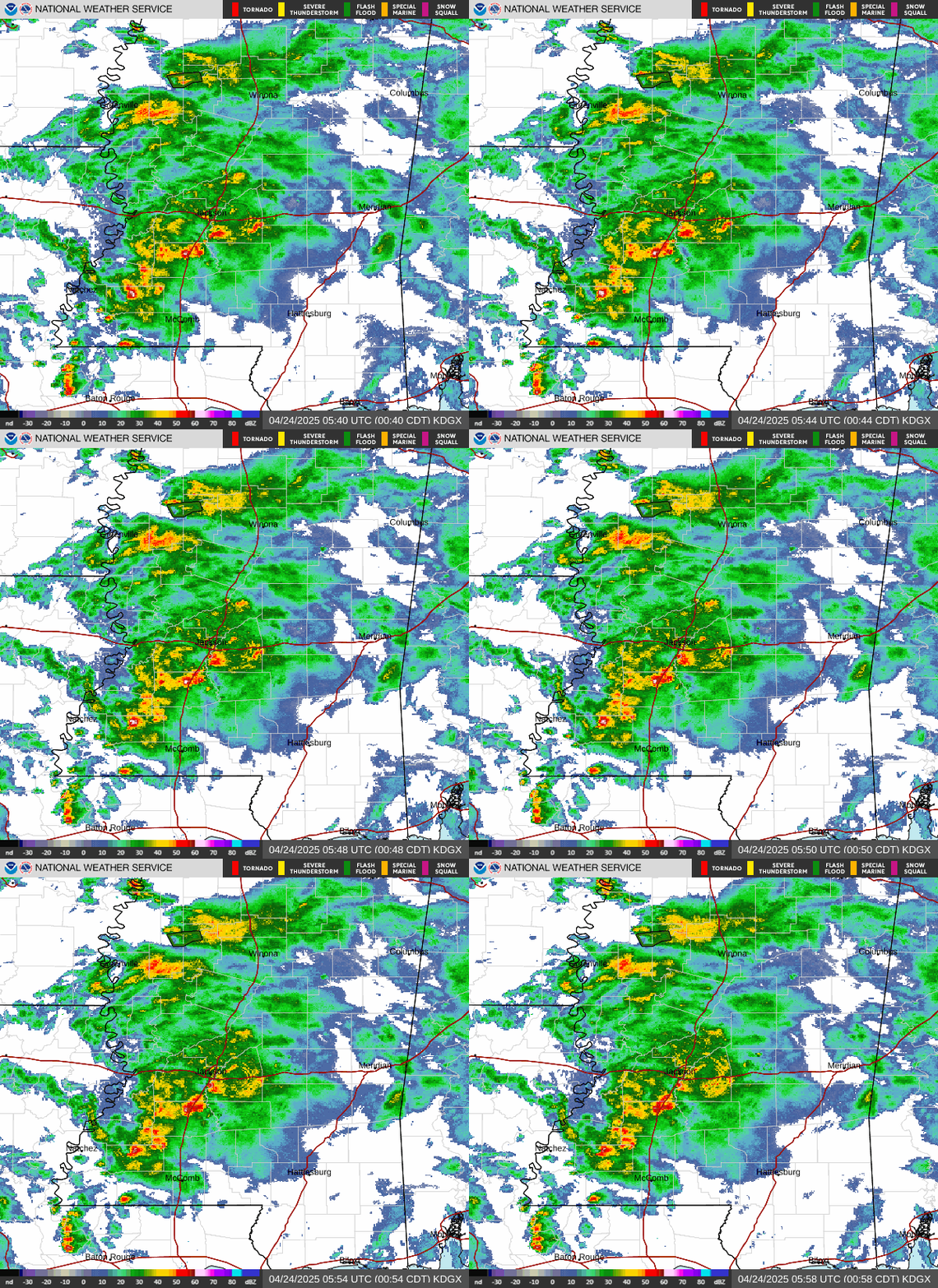
Radar — KDGX

Radar loop for KDGX

Surface Analysis — Central U.S. (South)

Surface map for Central U.S. (South)

Satellite

Satellite imagery
Expanded view