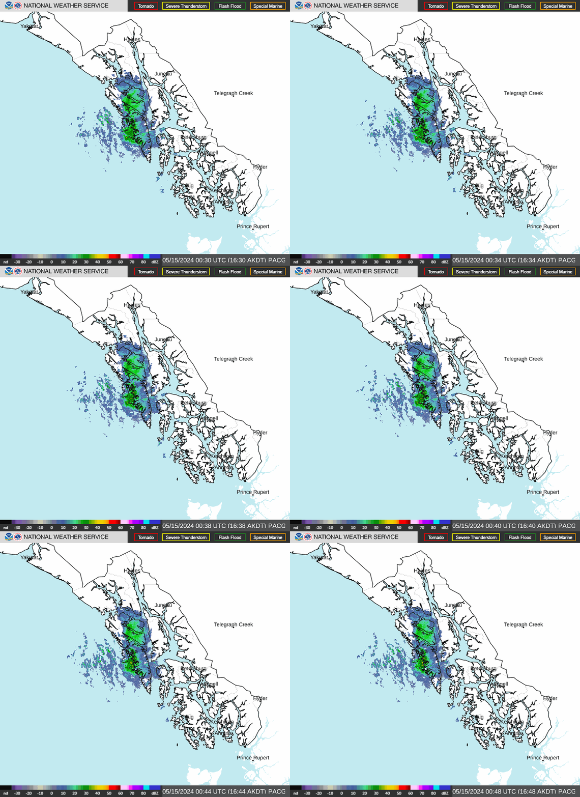
Radar — PACG
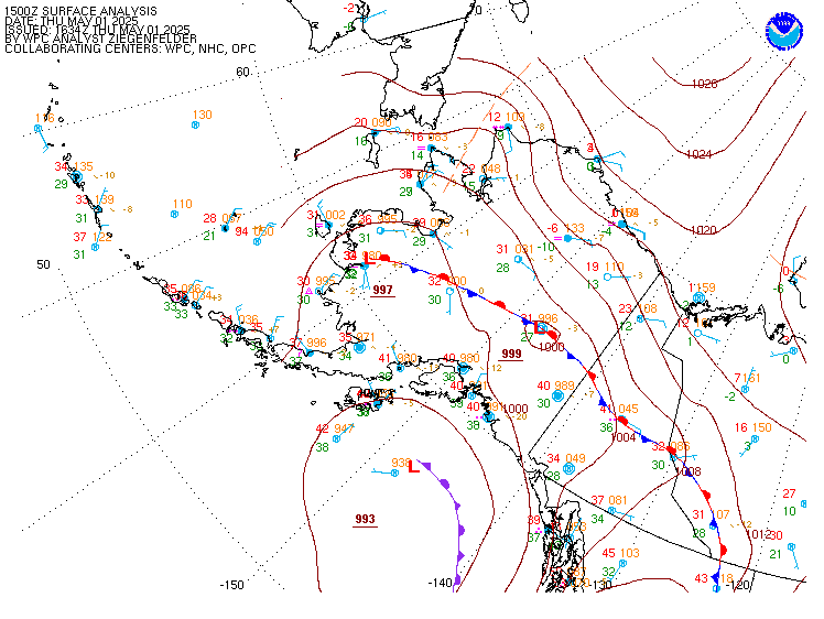
Surface Analysis — Alaska
Satellite

Log in to save this location.
Long term discussion updated along with the 06Z aviation forecast updated discussion. We have also been updating marine forecasts and placement/timing of gale warnings along and south of the front as it moves south through the eastern gulfak and the central/southern panhandle through sunday morning.
Key messages:
- a front will slowly push through the panhandle over the weekend, with gusty winds and moderate to heavy rain possible.
- heavy snow possible along upper klondike highway over the weekend with a winter storm warning in effect.
- the wet and active pattern will continue into next week as multiple fronts and lows pass through southeast alaska.
/through early next week/...
Our front continues to impact the panhandle this afternoon as the heaviest precipitation has moved over the northern and central panhandle. For yakutat, the precipitation has already come to an end with the front moving through. Behind the front, clearing skies with some showers are already visible on satellite. This front is expected to hang up over the central and northern panhandle tonight going into tomorrow morning. This will allow for precipitation to persist for this region which will bring more rain to the locations at the surface. As for the locations at elevation, snow will continue including places like white pass which will continue to see snow persisting through sunday before diminishing to some snow showers. After the front moves through, onshore flow will continue to persist to start the week which will bring rain showers. With the clouds and wind, temperatures will stay somewhat warmer than what they were at the end of the week. Cooler temperatures will still be possible though with the showers and decreasing amount of daylight. Active weather will continue going into the middle of the week.
/tuesday through thursday night/
An active fall pattern continues through the extended forecast, with short breaks of dry conditions in between passing systems. Maritime interests should remain aware of gale force fronts pushing across the gulf and along the coast on tuesday and thursday.
A long wave upper level trough over the aleutian chain swings the first of many fronts across the gulf through tuesday, with widespread sustained gale force winds 35 to 45 KTS and storm force gusts up to 55 KTS across the gulf and along the coast from CAPE decision northward to CAPE suckling through the day. Overland, strong winds remain possible across the central and southern panhandle given current forecast orientation of the front with gusts u for prince of wales, ketchikan, and metlakata by late tueday night into wednesday afternoon. By wednesday night, a seperate, but stronger low develops in the northern pacific as it deppens to ~970mb by thursday morning, and moves into the southern gulf of alaska. This low will swing a strong front acros the gulf through thursday, bringing another round of sustained gale force winds 35 to 45 KTS and storm force gusts up to 55 KTS across the gulf and along the coast from dixon entrance northward to the fairweather grounds through the day. Strongest overlands winds once again focused across the sotuerh npanhandle, however albiet less forecast confdience on location and expected gusts, but would not be suprised to see gusts up to 35 MPH by thursday evening for kethickan and metlakata (looking at you yellow hill).
As of now, no significant QPF concerns with this system given how fast each front is expected to push through. Periods of moderate to heavy rain are expected, but not expecting a long duration rainfall threat. Current rainfall amounts with each front is around 0.5-1.5" across the northern and central panhandle, 1-2" for the southern panhandle.
/through sunday evening/ the front continues a gradual push south of a sitka to juneau line late this evening, with a zone of increased winds east and south of the boundary and llws to 50 KT in lowest 2 thousand feet off the deck for a period of 4 to 6 hours with the frontal passage. The front will continue south into the southern panhandle through late morning, with ceilings and visibilities generally dropping to MVFR in rain. Brief periods to IFR possible just ahead of the front where a heavier band of rain moves through, but generally for planning purposes most taf sites will be MVFR through at least mid afternoon.
Outside: a strong front continues to push into the SE gulf coast saturday afternoon, having just pushed past buoy 46083 as of this discussion around 330PM. Winds of moderate to fresh breeze out of the southwest can be expected on the backside of this front, with seas of 15 to 20 ft through sunday night gradually subsiding to 10 to 15 ft through sunday afternoon. Seas will continue to subside from north to south sunday into monday. Winds and seas will build once again late monday into tuesday as another system moves into the gulf from the west.
Inside: the above mentioned front is gradually pushing its way into the SE ak panhandle saturday afternoon, with increasing easterly flow ahead of it along icy strait and cross sound, as well as on the backside of douglas island, with scull island gusting to around 40 KT since mid-morning. South to southeasterly winds will continue to build ahead of the front and peak later tonight into sunday for north/south oriented channels as the front lifts inland. Gales are still expected to develop late tonight and last through the first half of sunday for clarence strait as the front is reinforced by a wave riding up along it near haida gwaii. By sunday night however, winds across the inner channels will generally diminish to 15 KT or less.