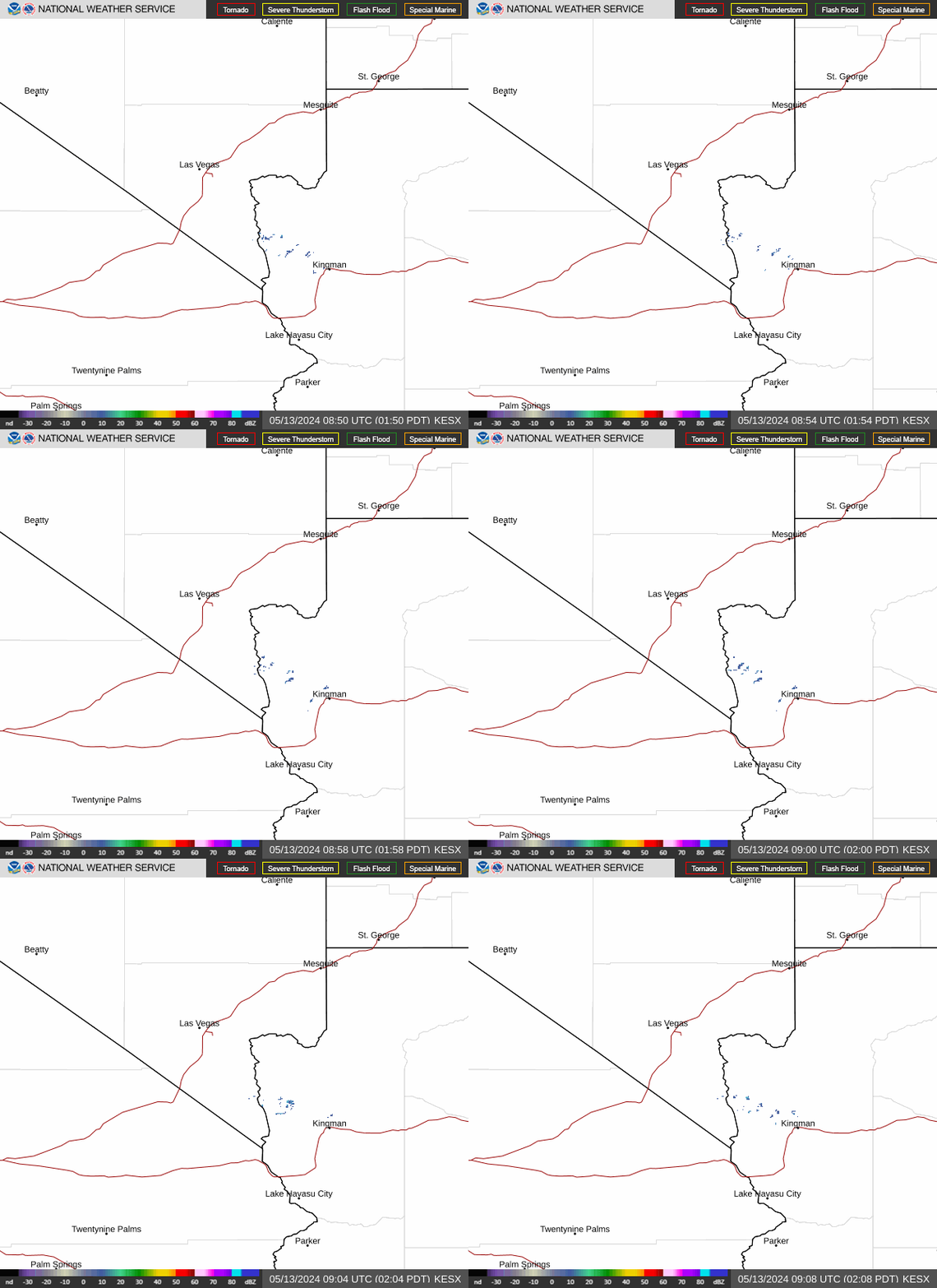
Radar — KESX
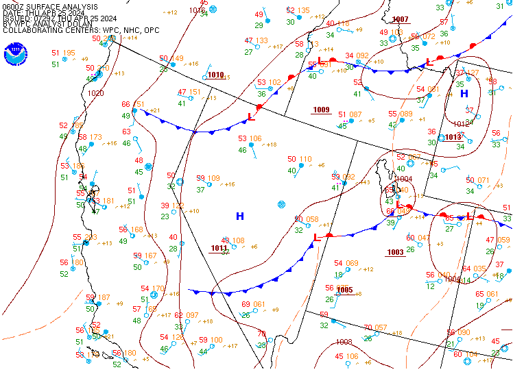
Surface Analysis — Western U.S. (Central)
Satellite

Log in to save this location.
Nearest monitored road: Las Vegas Boulevard North (Primary)
* isolated-to-scattered showers and thunderstorms expected today and thursday across our eastern zones.
* elsewhere, expect breezy south-southwesterly wind gusts through the week with dry conditions and near-normal temperatures.
Today through tuesday.
Expecting isolated-to-scattered showers and thunderstorms this afternoon across lincoln and mohave counties, with chances spreading into thursday morning. While the southern great basin remains situated under a dry southwesterly flow aloft, the southern mojave desert will experience a south-southeasterly flow, which will usher in 1.25 to 1.75 inches of PWAT into the region - specifically southeastern nevada and northwestern arizona. In addition to the moisture, there is a disturbance riding up the baja california that is currently highlighted by the NHC as having a 10 percent chance of tropical storm formation in the next 48 hours. While this disturbance is unlikely to become a cyclone, as it pushes northward, the vorticity maxima associated with it will lead the development of showers and thunderstorms across southern mohave county / the lower colorado river valley this afternoon. Additionally, energy riding along the upper-level trough across the western conus has closed off over northern california this morning and will begin its meander eastward across nevada this afternoon. The enhanced jet associated with this closed low will combine with daytime heating to facilitate convection across eastern lincoln, eastern clark, and mohave counties, which is in- line with the latest cam guidance. That said, there is a noticable PWAT gradient across the center of our forecast area, which could act as a dryline, resulting in convection developing a bit further west than guidance currently suggests. Will continue to keep an eye on locations along and west of interstate 15 as the day progresses. As a result of ample instability and moisture, thunderstorms that form are expected to be efficient rain- makers with frequent lightning, which will elevate the risk of flash flooding, particularly across mohave county and underneath training storms. Forecast HRRR soundings in south-central mohave county show over 1750 j/kg of sbcape, 750-1000 j/kg of dcape, 1.50 inches of PWAT, and 500 mb cooling (lis around -4 degrees c), so severe thunderstorms are likely as well.
The trough axis associated with the aforementioned closed low will push through the forecast area today and thursday, resulting in elevated south-southwesterly winds with gust speeds generally between 25 and 35 MPH. Cannot rule out occasional gusts to 40 MPH in the higher terrain. Otherwise, persistent troughing over the western conus will result in afternoon high temperatures near- normal for mid-september. Cloud cover heading into overnight periods may result in elevated morning lows, however.
For harry reid...for the 18Z forecast package... Gusty SE winds have begun across the las vegas valley today. Similar to yesterday, a stronger easterly pressure gradient over the area may keep the easterly wind component around through mid afternoon. Confidence is low on the exact hour of the wind shift to S-SW, but current thinking is that it should occur after 20Z, potentially as late as 22Z. Expect gusts 20-25 KT while winds are SE, then gusts up to 30 KT possible late evening through 03Z after the SSW shift occurs. Late afternoon and evening thunderstorm activity is expected to remain east of the terminal over northwestern arizona and the mormon mesa corridor, with VFR conditions prevailing. Not currently expecting outflow from storms to impact the valley, but will monitor storm and outflow evolution closely. Few-sct clouds with bases around 10kft can be expected this afternoon and tonight, with temperatures remaining under 100 degrees.
For the rest of southern nevada, northwest arizona and southeast california...for the 18Z forecast package...southeast winds are increasing late this morning with gusts exceeding 20 KT in the crv. Expect a shift to the S-SW around 20-22Z. Gusts to around 25KT will be common across the region, with stronger gusts to around 30KT in the northern owens valley and along the lower colorado river valley where up-valley winds develop. Kdag is the usual exception with W winds around 10 KT persisting through the day, then expect the WSW push around and after 23Z with gusts 20-25+ KT into the early overnight hours. Elsewhere, speeds and gusts diminish after sunset, but hi-res guidance continues to indicate elevated winds and isolated gusts for the crv overnight with the potential for impacts from outflow boundaries. Thunderstorms are expected this afternoon and evening over eastern areas, and especially over northwestern arizona, with impacts from lightning and gusty outflow winds possible at both keed and kifp. Few-sct clouds with bases at or above 10kft are expected this afternoon onward for most of the region, with lower ceilings and greater coverage in the vicinity of thunderstorms.
Spotters are encouraged to report any significant weather or impacts according to standard operating procedures.