Radar — KLVX

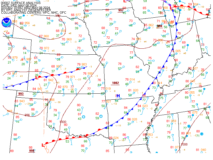
Surface Analysis — Central U.S. (Central)
Satellite

Log in to save this location.
Nearest monitored road: West Jefferson Street (Secondary)
* heat advisory remains in effect until thursday evening.
* unseasonably hot temperatures continues with highs in the mid to upper 90S and heat index values between 100-105.
* weak sfc boundary brings low end (20-30%) rain chances for friday
* while not as hot, temperatures in the low to mid 90S expected for the weekend.
Issued at 150 PM EDT wed sep 16 2026
Heat advisory remains in effect until thursday evening thanks to the strong anomalous 600dm upper-level ridge. As of early afternoon temperatures were already in or just around 90 with heat index values near 100 degrees. The only potential impact in the weather outside of the heat is a stalled sfc boundary across northern in, north if the i-70 corridor. Radar was showing a few isolated cells forming across central in this afternoon, while the chance of an isolated shower can't be ruled out, given how far north the main boundary is to the cwa, overall confidence in precipitation is rather low.
It will remain mostly clear overnight with temperatures staying warm and bottoming out in low 70S with urban locations seeing lows in the mid 70S with light winds providing very little relief from the overall heat. By tommorow, the upper ridge continues its influence over the region as it shifts slightly westward. The stalled boundary across northern in lifts northward allowing for temperatures to once again heat back into the mid to upper 90S with heat index values between 100-105.
Issued at 150 PM EDT wed sep 16 2026
Stalled sfc boundary will drift southward towards the ohio valley and the commonwealth thursday night into friday morning. This will increase shower/storm chances across the cwa especially over southern in, north central ky and over the bluegrass region. Current forecasts continues to show a 20-30 percent chance of pops. There remains some uncertainty on how far south this boundary will go across the state of ky. The placement of this boundary will have a large influence on not just potential shower and storm potential but also on our temperatures. The is some guidance that is starting to suggest the boundary could go as far south as the ky/tn border. If this scenario plays out we would not need to continue the heat advisory into friday. If it stops short and makes it to only central ky then some of our counties to the south and west may need to continue the heat advisory for another day. Given the lack of confidence, it was decided to wait on more data and confidence before extending the current heat advisory for friday.
Front will lift north again to start the weekend but the center of the upper ridge will be further west. While we will see temperatures both saturday and sunday return to the low-mid 90S, heat index values will not be as hot. The forecast continues to look mainly dry for the weekend.
Pattern flattens out and becomes more zonal for early next week with a series of systems working through the region with a cold front pushing through during the first half of the week. This should bring cooler temperatures in the 80S by the middle of next week with some showers and possible storms.
Issued at 1146 AM EDT wed sep 16 2026
VFR flight categories remain through the forecast period thanks to strong anomalous 600cm upper ridge and sfc high pressure. Sfc boundary is to the north over indiana. Some mid-level cu likely will develop in the afternoon and while there is a very small chance of an isolated shower/storm (less than 10%) most terminals should remain dry. This will continue going into the overnight.