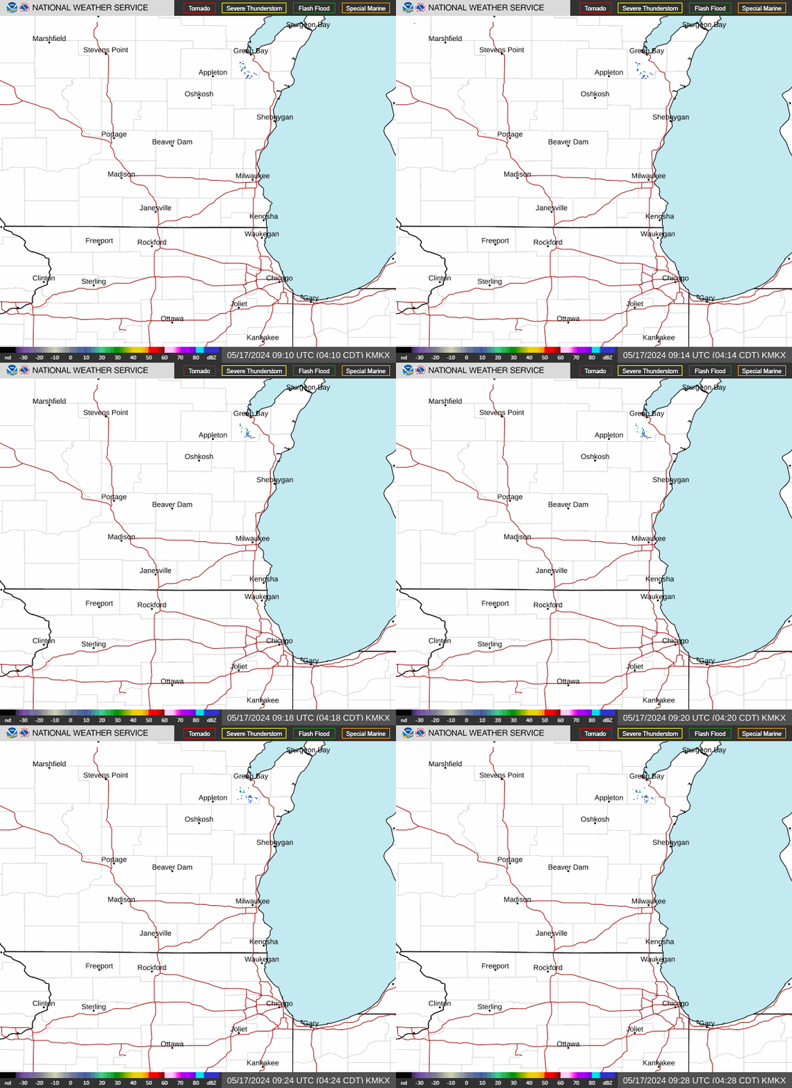
Radar — KMKX
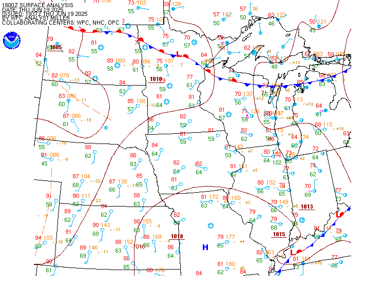
Surface Analysis — Central U.S. (North)
Satellite

Log in to save this location.
Nearest monitored road: US-18 (Primary)
- periods of widespread rain & isolated storms arrive tomorrow and continue into tuesday night.
- hit & miss showers linger wednesday & thursday.
- drier and cooler conditions friday into next weekend.
Issued 536 PM CST sun nov 1 2026
The light returns on radar that are over south central wi may be producing sprinkles at this time. The area should track northward through southern wi this evening, and this is due to weak vorticity advection. The overnight hours could feature drizzle at times as low level moisture begins to move in.
Cronce
Issued 150 PM CST sun nov 1 2026
Tonight through wednesday night:
Synopsis/mesoanalysis: upper ridging is building into the upper mississippi valley this afternoon, with affiliated subsidence having scoured out mid-upper clouds that were in place earlier this morning. Temperatures have warmed nicely in locations experiencing the most clearing, with more modest rises noted in spots that have stayed a touch cloudier. Expecting current trends to continue through the rest of the afternoon, with spots in the sun climbing toward 70 degrees and cloudier spots remaining in the 60S. Aforementioned ridging will drift east over lake michigan tonight as an upper trough moves from the great basin into the central rockies. Concurrent lee cyclogenesis will occur over northeast colorado, with low continuing to deepen as it moves into south dakota on monday. Increasing warm advection ahead of the low will support increasing rain chances monday, particularly across the northwest. The surface low will occlude near the south dakota-minnesota border monday night, with its affiliated occluded front slowly crossing the area tuesday afternoon & evening. The approaching/passing front will bring the most widespread rain chances of the period, with a few storms possible. Widespread precip will push east of the region with the occluded front late tuesday night. More scattered & hit/miss rain chances will continue wednesday & wednesday night as upper troughing makes it into the western great lakes.
Rest of this afternoon: have maintained slight chance mentions of drizzle and sprinkles near the wisconsin-illinois border in far southeast wisconsin. Activity has festered with the help of lift from a weak shortwave over north-central illinois, though northward progress has been curbed by a weak surface ridge in place over east- central wisconsin. Despite these trends, can't rule out some activity leaking north of the state line before supporting lift pivots away from the area. Not expecting any measurable rainfall in any activity.
Tonight: could see some additional areas of light sprinkles or drizzle as a modest 25-30 knot low level jet works across southern wisconsin & moistens the low levels. Have added some mentions in the afternoon forecast. Like this afternoon, not anticipating any measurable rainfall in any drizzle/sprinkles.
Monday-tuesday morning: will see broad areas of rain expand in coverage over the upper mississippi valley thanks to large scale increases in warm advection ahead of low pressure in south dakota. Eastward extent of precip remains questionable given 1) better warm advection/isentropic ascent from northern wisconsin toward the mississippi river and 2) lingering influences from upper ridging lingering near lake michigan. Tend to think that these factors will lead to the bulk of widespread rainfall remaining over the northwest half of the area through this portion of the period, with some potential for areas in far southeast wisconsin to stay largely dry. Have adjusted precip probabilities to reflect this thinking. Could see a few thunderstorms mix in with the steadier rains over the northwest, with severe weather not anticipated.
Tuesday-tuesday night: expecting all of the area to get into widespread rain along a passing occluded front. Forecast soundings show weak (~100-250 j/kg) mucape along the passing boundary, so a few embedded thunderstorms will continue to be a possibility. The weak instability values should curb any stronger storm potential, but will be monitoring for any upward trends over coming updates. Could see brief heavy downpours in any thunderstorms, with flooding potential appearing low at this time. Between monday-monday night & this batch of precip, appears that rainfall totals of at least 0.5" will be a good bet areawide, with some potential for totals reaching or exceeding 1" across the west. Will continue to refine the rainfall forecast and provide additional updates through tomorrow.
Wednesday-wednesday night: with upper troughing approaching, scattered rain chances will remain a part of the forecast picture. More widespread/prolonged activity will likely be thwarted, however, by drier mid-level air moving in from the southwest. Have maintained precip forecasts from the nbm in this update, which are resolving the encroaching dry slot well.
Quigley
Issued 150 PM CST sun nov 1 2026
Thursday through sunday:
Synopsis: upper troughing will continue across and through the area during the day on thursday, with pop-up rain showers possible during the afternoon hours. Surface winds will trend northwesterly behind the departed trough, bringing cooler air to southern wisconsin during the friday-saturday time frame. Expecting near-normal highs in the low-mid 50S during this period, with seasonably cool overnight lows in the 30S. Global guidance hints at the arrival of the next disturbance by the end of next weekend, with rain chances returning on sunday.
Quigley
Issued 536 PM CST sun nov 1 2026
Mid level clouds and some sprinkles are expected this evening. The MVFR ceilings should hold off until at least early mon morning as low level moisture spreads into the region. There could be drizzle with this moisture return. A period of light rain showers or sprinkles is possible between mid morning and early afternoon, but the forcing is not clearly defined.
With increasing southeast winds in the late afternoon and a deeper moisture profile, ceilings will be solidly in MVFR. IFR is possible after 00Z/6PM once the more numerous showers arrive.
Cronce
Issued 150 PM CST sun nov 1 2026
High pressure near 1032 mb will drift southeast into the northeastern united states through this afternoon, maintaining south- southeasterly winds over lake michigan. Low pressure near 1000 mb will develop over eastern colorado this evening, progressing into the upper mississippi river valley by early tuesday morning. Winds will steadily become gusty ahead of the low, approaching or exceeding gale force over at least the central third of the lake tuesday afternoon and evening. Anticipate that headlines will become necessary in later forecasts. Rain will accompany the approaching/passing low monday through tuesday night, with a few thunderstorms possibly mixing in. Severe weather is not expected at this time.
Winds will remain breezy, though likely below gale levels wednesday and wednesday night as 1020 mb high pressure slowly builds into the canadian great plains. Said high will move into the western great lakes through the second half of next week, allowing for westerly and eventually northerly winds by next weekend.
A prolonged period of gusty winds and elevated wave heights remains anticipated from monday through at least wednesday morning. A small craft advisory is now in effect between 9 AM CST monday and 3 PM CST wednesday. A shorter period of gales is possible, with trends being monitored for possible gale headlines over later forecasts. Most likely period for gales will be late tuesday morning through the afternoon, with areas north of wind point having the best potential of seeing gales. Conditions will improve wednesday night into thursday.
Quigley