Radar — KMKX
Surface Analysis — Central U.S. (North)
Satellite

Log in to save this location.
Nearest monitored road: 7th Street (Primary)
- fog and light mist/drizzle expected to continue over the next few hours.
- brief moderate to high swimming risk with a beach hazards statement in effect for waves to 4 feet. Additional prolonged period of moderate to high swimming risk conditions expected friday evening into early next week.
- periods of widespread showers & storms expected friday evening through saturday. Locally heavy rainfall and flooding impacts are possible.
- off & on lighter rain sunday into early next week, especially closer to wi/il border. Conditions dry out by mid-week.
Issued 145 PM CDT thu sep 17 2026
Tonight through saturday:
Tonight expect high pressure to nudge into the region a bit more as the high in as the high in south central canada strengthens. This should shove some of the moisture and thicker low clouds to the south for the time being. However, low to mid level moisture may hang around just long enough to prevent total clearing by friday morning ahead of the next system with upper level clouds expected to roll in from the west.
This next system pushing in friday and exiting saturday will be fairly significant with deep moisture column, high pwats (>2 inches), some strong waa from llj influence, upper level shortwave energy and fgen. The latter of which looks to be the most important for where we could expect the highest rain totals. While thunderstorms are likely, any storms are not expected to be strong nor is lightning expected to be frequent or widespread. Thus, the primary focus from our end is the potential for prolonged moderate to heavy rainfall and more specifically, any area that may receive training moderate to heavy rainfall for multiple hours. Some models show a focused band of precip being the main issue where others show just a blob of widespread precip. The worst case scenario is the training moderate to heavy rain in the form of a band as this likely brings the highest end outcome for rain totals. In general expect 1.5 to 2.5 inches for this period with and a higher end outcome possible that could tap into the 4-6 inch range with that (if it occurs at all) more likely in a very localized region.
There will be concerns for areal flooding and even some minor flash flooding and river flooding potential all dependent on how it falls, how long and where. Thats where the uncertainty remains with this event as we have tracked this event gradually shifting south over the last few days and thus if that trend continues our southern cwa would be in the crosshairs while currently the central and northern parts of our cwa still have the highest chances for high end rainfall through saturday. A great portrayal of this is what we see in the href pmm or lpmm for 24 hour precip which shows 2 separate areas of high end rainfall but in reality we would only really be expecting 1 band located across part of southern wi, assuming we get a major band to begin with as that is not a certainty.
The primary period for the heaviest rainfall according to models will be largely falling late friday night into saturday morning with most of the rain pushing out sometime saturday morning with more so lingering precip into saturday afternoon.
Kuroski
Issued 145 PM CDT thu sep 17 2026
Saturday night through thursday:
More uncertainty climbs into the forecast beyond the friday/saturday rain event as much depends on the interaction between the low pressure in the south central US and the high pressure in south central canada. In addition, where the best moisture and forcing line up with respect to those interactions and the fact that we will be in a zonal flow regime aloft makes things very uncertain. Models generally portray that same picture as well with differences in exactly where the precip may line up. Latest trends do suggest precip may sag further south with primarily the southern tier of counties seeing the greatest potential for rain saturday night into sunday.
Another chance for showers and maybe weak storms monday as a more substantial shortwave swings through though moisture depth will be lacking relative to the previous days and may ultimately impact how much rain we actually see. While this period will bring rain we do not expect much instability with this overall and thus while embedded storms are expected, widespread lightning is not.
Into tuesday, some lingering precip chances look to be possible as the backside of the upper level shortwave swings through but after that we trend drier with higher pressure building directly over the region. With uncertainty in the earlier portions of the forecast comes built in uncertainty with this portion but models generally agree on a less active pattern for the area overall. We will continue to monitor conditions as the upper levels will still support several systems pushing through its just a matter of whether the high and assumed low level dry air prevents much in the way of precip.
Kuroski
Issued 220 PM CDT thu sep 17 2026
Fog in southeast wi and lighter fog extending further west continues and looks like to be steady state for at least the next few hours. The current thought is that this fog will dissipate or push out as winds pick up a tad from the northeast late this afternoon into the evening. Low vlifr to MVFR cigs will continue through the afternoon, gradually rising into the evening before pushing out of southern wi mid evening to the early overnight hours. VFR conditions expected later tonight outside of some patchy fog expected to the west which may bring temporary vsby degradation though not likely to impact taf sites. Into friday morning while quiet we will be monitoring the next system coming in friday afternoon into saturday with low cigs and vsbys with moderate to heavy rain expected.
Kuroski
Issued 255 PM CDT thu sep 17 2026
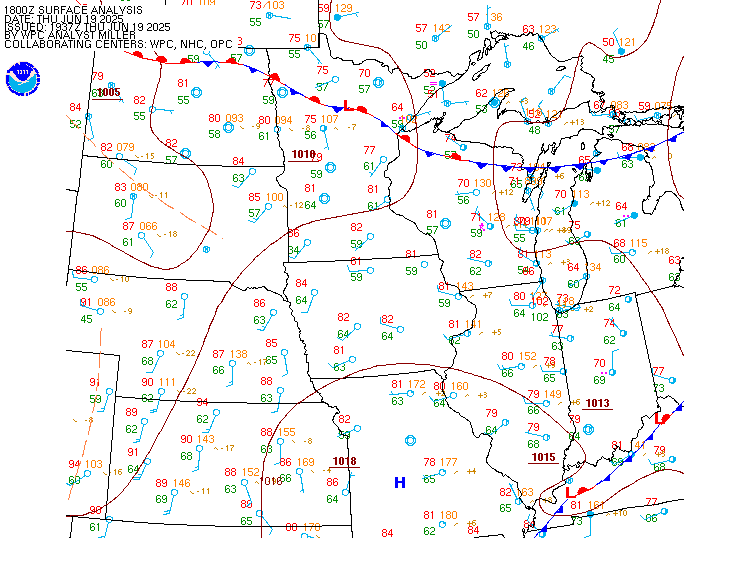
Light and variable winds over the north half of the lake this afternoon and light northeast winds over the south half, will become a steady and modest east northeast wind over the entire lake tonight and friday. This will occur as an area of 30.4 inch high pressure will shift from manitoba into ontario.
29.9 inch low pressure will develop near the middle missouri river friday afternoon then gradually shifting to the northern ohio valley for saturday afternoon and night, and persist into early next week. Breezy east southeast winds will develop over the south half of the lake friday night and saturday becoming northeast late saturday night into early next week. Widespread showers and storms will accompany the approaching and passing low friday night through at least saturday night, with widespread severe weather not expected.
Gehring