28/159 PM.
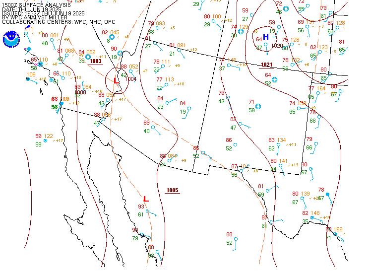
Extreme heat with moderate to high heat risk will peak friday through at least sunday as a rare very strong ridge builds into the region. No significant relief from the heat is on the horizon once the heat wave starts. Night to morning clouds will diminish or disappear, leaving sunny skies.
29/0207Z.
At 2134Z at klax, the marine layer was 1500 feet deep. The top of the inversion was 4200 feet with a temperature of 24 degrees celsius.
For 00Z taf package, high confidence in kprb, and kpmd and kwjf.
For ksbp, ksmx, koxr, klax, ksmo, klgb and kcma, moderate confidence in 00Z tafs as timing of return of cig/vsby restrictions could be +/- 2 hours of current forecasts. Cigs may briefly reach kbur and kvny.
For ksba, lower confidence in cigs. There is a 20% chance of IFR conditions 10Z-17Z.
Klax...moderate confidence in 00Z taf. Timing of flight category changes could be +/- 2 hours of current forecasts. There is a 30% chance that cigs could return at MVFR levels tonight. No significant easterly wind component is expected.
Kbur...moderate confidence in 00Z taf with cigs possible after 10Z.
28/814 PM.
For the outer waters, moderate to high confidence in current forecast. Local gusts to 35 knots will affect the outer waters through around midnight. Otherwise, through sunday, high confidence in a combination of small craft advisory (sca) level winds and seas. There is also a 20-30% chance of gale force winds across western sections of pzz670/673 wednesday evening.
For the inner waters north of point sal, moderate to high confidence in current forecast. Through sunday, there is a 60-80% chance of sca level winds in the afternoon and evening hours.
For the inner waters south of point conception, moderate to high confidence in current forecast. For a majority of the southern inner waters, high confidence in winds and seas remaining below sca levels through sunday. The only exception will be the western half of the santa barbara channel with a 60-80% chance of sca level winds through late tonight then a 30-50% chance of sca level winds wednesday through sunday in the late afternoon and evening hours.
Seas are expected to hover near 8-10 feet across the waters away from the coasts much of the week. There is a steep (short period) NW swell/wind wave from the persistent winds. In addition, a southerly swell from hurricane genevieve will continue across the coastal waters through this weekend. This south swell may impact south facing harbors, including port san luis.
28/808 PM.
An extended period of combined moderate to long period southerly swells will continue through this week and into the upcoming weekend. A long 17-20 second period SSW southern hemisphere swell will continue to impact our area through mid week, then will be enhanced by southerly swell from category 5 hurricane genevieve, moving into the coastal waters today.
A beach hazards statement is in effect through wednesday morning (except through saturday along the central coast) due to the increased risk of dangerous rip currents and elevated surf. There have been numerous ocean rescues reported.
A high surf advisory remains is now in effect from wednesday morning through saturday evening for the incoming southerly swell due to hurricane genevieve (along with other southerly swells) particularly for south facing beaches (such as from manhattan beach to port hueneme along the malibu coast, and from long beach to the palos verdes peninsula). This swell will peak around 3-5 feet at 12-15 seconds from 160-180 degrees.
Additionally, a coastal flood advisory has been issued for wednesday evening through friday evening for the ventura and los angeles county coasts. High tides of 6.2-7.0 feet will peak in the evening hours. In conjunction with the highest expected surf from the hurricane genevieve southerly swell, the best potential for minor coastal flooding impacts is expected wednesday and thursday evening. Generally minor impacts are expected, such as pooling of seawater over low lying coastal areas in susceptible areas.