Weather Lookup

⚠ Active Alerts

Extreme Heat Warning Extreme Heat Warning issued July 29 at 2:19AM EDT until July 29 at 7:00PM EDT by NWS Charleston SC

Current Conditions — KSVN

86°F Clear
💧 Humidity 72%
💨 Wind 6 mph WSW
👁 Visibility 10.0 mi
🌡 Pressure None inHg

Hourly Forecast — Savannah,GA

2:00 AM 84°F Partly Cloudy 💨 8 mph SW
3:00 AM 83°F Mostly Clear 💨 8 mph SW
4:00 AM 83°F Mostly Clear 💨 9 mph SW
5:00 AM 82°F Mostly Clear 💨 9 mph SW
6:00 AM 82°F Mostly Sunny 💨 9 mph W
7:00 AM 81°F Mostly Sunny 💨 8 mph W
8:00 AM 81°F Mostly Sunny 💨 8 mph W
9:00 AM 83°F Mostly Sunny 💨 8 mph W
10:00 AM 86°F Mostly Sunny 💨 9 mph W
11:00 AM 89°F Partly Sunny 💨 9 mph W
12:00 PM 92°F Mostly Sunny 💨 9 mph W
1:00 PM 94°F Partly Sunny 💨 9 mph W
2:00 PM 96°F Slight Chance Showers And Thunderstorms 💨 9 mph W
3:00 PM 96°F Slight Chance Showers And Thunderstorms 💨 9 mph W
4:00 PM 96°F Slight Chance Showers And Thunderstorms 💨 8 mph W
5:00 PM 95°F Slight Chance Showers And Thunderstorms 💨 8 mph W
6:00 PM 93°F Slight Chance Showers And Thunderstorms 💨 8 mph W
7:00 PM 92°F Chance Showers And Thunderstorms 💨 7 mph W
8:00 PM 89°F Slight Chance Showers And Thunderstorms 💨 6 mph W
9:00 PM 87°F Slight Chance Showers And Thunderstorms 💨 5 mph S
10:00 PM 85°F Slight Chance Showers And Thunderstorms 💨 5 mph SW
11:00 PM 84°F Partly Cloudy 💨 5 mph W
12:00 AM 83°F Mostly Cloudy 💨 5 mph W
1:00 AM 82°F Mostly Clear 💨 5 mph W

Daily Forecast — Savannah,GA

Overnight 81°F Mostly Clear 💨 9 mph SW
Wednesday 99°F Mostly Sunny then Slight Chance Showers And Thunderstorms 💨 9 mph W
Wednesday Night 77°F Chance Showers And Thunderstorms then Partly Cloudy 💨 5 to 8 mph W
Thursday 95°F Sunny 💨 6 mph NE
Thursday Night 76°F Mostly Clear 💨 1 to 6 mph S
Friday 93°F Sunny then Slight Chance Showers And Thunderstorms 💨 1 to 9 mph E
Friday Night 78°F Slight Chance Showers And Thunderstorms then Partly Cloudy 💨 2 to 9 mph SE
Saturday 92°F Mostly Sunny then Chance Showers And Thunderstorms 💨 2 to 12 mph S
Saturday Night 77°F Chance Showers And Thunderstorms 💨 5 to 12 mph S
Sunday 90°F Showers And Thunderstorms Likely 💨 5 to 14 mph SW
Sunday Night 76°F Showers And Thunderstorms Likely 💨 6 to 13 mph SW
Monday 91°F Slight Chance Showers And Thunderstorms then Chance Showers And Thunderstorms 💨 6 to 10 mph SW
Monday Night 77°F Showers And Thunderstorms Likely 💨 2 to 9 mph SW
Tuesday 92°F Chance Showers And Thunderstorms 💨 2 to 8 mph SW

🚗 Road Conditions

Good

Nearest monitored road: West Bay Street (Primary)

2:45 AM Good
3:00 AM Good
3:15 AM Good
3:30 AM Good
3:45 AM Good
4:00 AM Good
5:00 AM Good
6:00 AM Good

Forecast Discussion — CHS

View Full Discussion on NOAA →

What Has Changed

The aviation section was updated to reflect the 00Z forecast.

Key Messages

- 1) an isolated strong to severe thunderstorm will be possible late this evening, mainly for charleston tri-county. A few strong to severe thunderstorms are possible across extreme southern georgia late wednesday afternoon and evening. The primary threat will be damaging wind gusts.

- 2) dangerous heat and humidity will impact southeast georgia and southeast south carolina through wednesday.

Discussion

Key message 1: an isolated strong to severe thunderstorm will be possible late this evening, mainly for charleston tri-county. A few strong to severe thunderstorms are possible across extreme southern georgia late wednesday afternoon and evening. The primary threat will be damaging wind gusts.

Regional radar showed a developing squall line over the mid- appalachians this afternoon. This line should race southward, reaching western nc by late this afternoon. The area ahead of the squall line has been highlighted with a severe thunderstorm watch until 8 PM. Dcape values are expected to range between 1000-1500 j/kg across the western carolinas, likely supporting a deep cold pool associated with the thunderstorms. Conditions ahead of the storms across the midlands of sc will begin to stabilize after sunset this evening, however, enough elevated CAPE should be in place to support deep convection. 12Z href indicates that 0-3 km srh should remain between 150-200 m2/S2 from the midlands to the sc lowcountry. The elevated instability and adequate SHEAR may allow some storm clusters to remain fairly organized and possibly severe as the storms reach northern berkeley and dorchester counties late this evening. Therefore, a severe thunderstorm watch may be needed for berkeley and dorchester counties late this evening into early wednesday morning.

A cold front is timed to push over extreme southern ga late wednesday afternoon and evening. Given the hot and humid conditions, moderate instability is forecast along and south of the front. High resolution guidance indicates that a frontal wave may develop along the front, possibly focusing an area of 0-1 km srh in excess of 100 m2/S2. A few storms may develop very tall cores, possibly yielding damaging winds below collapsing rain-loaded updrafts.

Key message 2: dangerous heat and humidity will impact southeast georgia and southeast south carolina through wednesday.

Similar to yesterday, hot conditions continue to prevail across the region, with latest observations showing temperatures in the low to mid 90S and dewpoints in the mid 70S. Despite there being an influx of cloud debris from the north, expect both of these values to increase a few more degrees this afternoon, yielding heat index values of 108+ degrees. This is especially true for areas along the coastal corridor, where dewpoints are expected to surge in the wake of an advancing sea breeze, which may produce isolated heat index values of 112+ degrees. Nonetheless, believe the duration of these should remain limited enough to forgo upgrading to an extreme heat warning at this time. So, will continue to carry the area wide heat advisory through 7 PM.

Wednesday: a strong mid-level ridge will prevail over the rockies and plains, with the eastern periphery building into the southeastern states. At the surface, weak high pressure will develop over the southeast. Between the ridging aloft and the weak high pressure at the surface, temperatures will soar into the mid to upper 90S. Dew points during this time will also rise into the mid to upper 70S, with the highest values along the coastal corridor behind the sea breeze. This set up will yield heat index values in the 105-112 range, with a few pockets of 112+ degrees. One complicating factor though, will be the chances for afternoon convection as models still differ regarding the degree of coverage. The current forecast features pops in the 25-50% range, however, if this trends wetter, our actual temperature/dewpoint/heat index values could run lower than forecast. Thus, after collaboration with neighbors, have decided issue a heat advisory for portions of our area, which will be in effect from 11 AM to 7 PM. Will continue to monitor trends in the event that an upgrade along the coast is needed.

Aviation — 00Z Wednesday Through Sunday

00Z tafs:overall VFR conditions prevail at all area terminals and with light southwesterly winds inland and southerly behind a slowly advancing seabreeze. A line of showers and thunderstorms currently over north carolina will approach the area from the northwest likely reaching the chs area by around 04Z. Storms are expected to weaken and there is some uncertainty on if precipitation even survives to impact the taf sites in the tri- county area. However; if storms do make it to chs/jzi, brief flight restrictions may occur. Winds will shift out of the northwest around 12Z at chs and jzi with VFR conditions prevailing area wide through tomorrow. Winds should remain out of the southwest at sav tomorrow with occasional gusts to around 15 knots tomorrow afternoon.

Extended aviation outlook: brief flight restrictions are possible thursday due to showers and thunderstorms.

Marine

Through tonight: a weak front will approach the region this afternoon, yielding an increase in both winds and seas this evening into tonight. A small craft advisory will be in effect for the charleston county nearshore waters and the 20 to 60 nm offshore ga waters. Conditions within the charleston harbor will need to be monitored for a possible short-duration small craft advisory as gusts could approach 25 knots this evening.

Wednesday through sunday: winds and seas will decrease wednesday morning to below small craft advisory criteria. Southeasterly flow will dominate across the marine waters through the weekend, with gusts topping out around 10 to 15 knots through friday. Gusts are forecast to shift to the SW and increase to 15 to 20 knots this weekend as a cold front approaches the region. Wave heights may range from 2-4 ft on wednesday, decreasing to around 2 ft on thursday through the rest of the week.

Climate

Record high minimum temperatures:

July 28: kchs: 80/2025

July 29: kchs: 80/2016 ksav: 82/1878

August 1: ksav: 79/2020

August 2: kchs: 79/2022

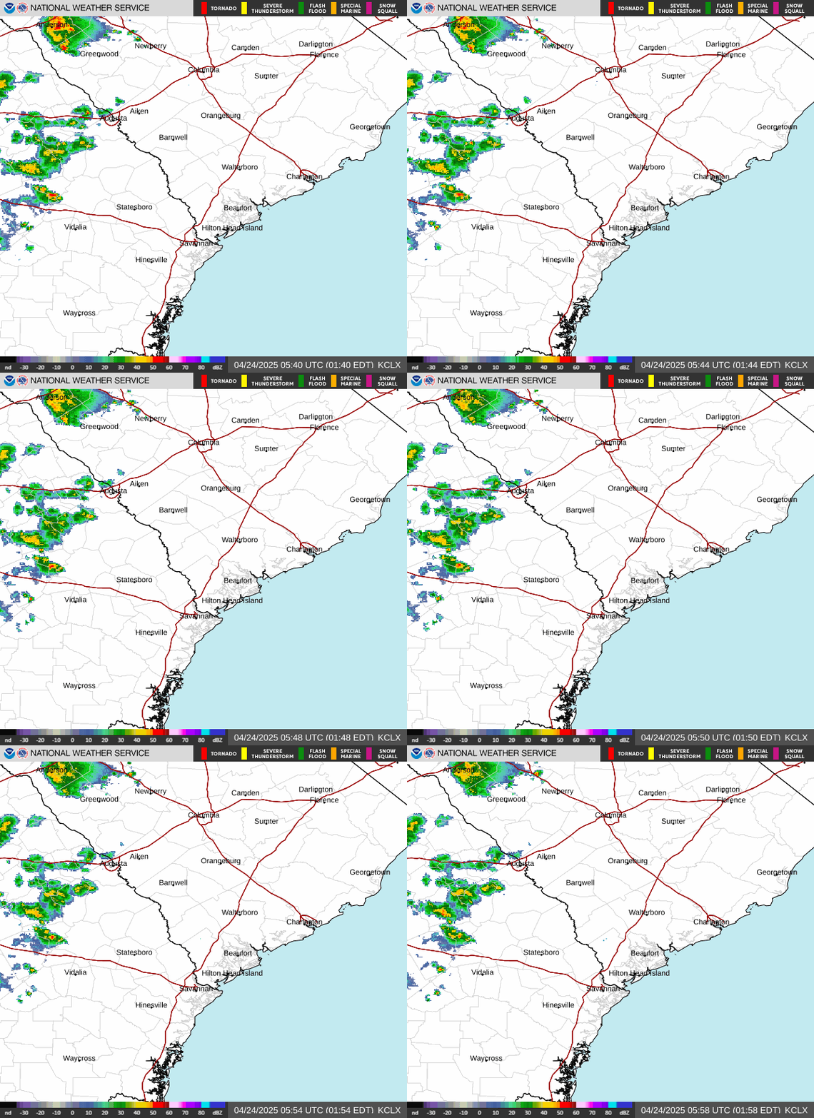
Radar — KCLX

Radar loop for KCLX

Surface Analysis — Eastern U.S. (South)
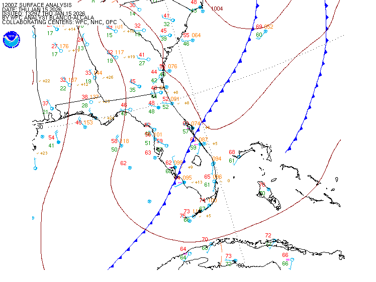
Surface map for Eastern U.S. (South)

Satellite

Satellite imagery
Expanded view