Radar — PACG
Surface Analysis — Alaska
Satellite

Log in to save this location.
Aviation update for 18Z taf issuance
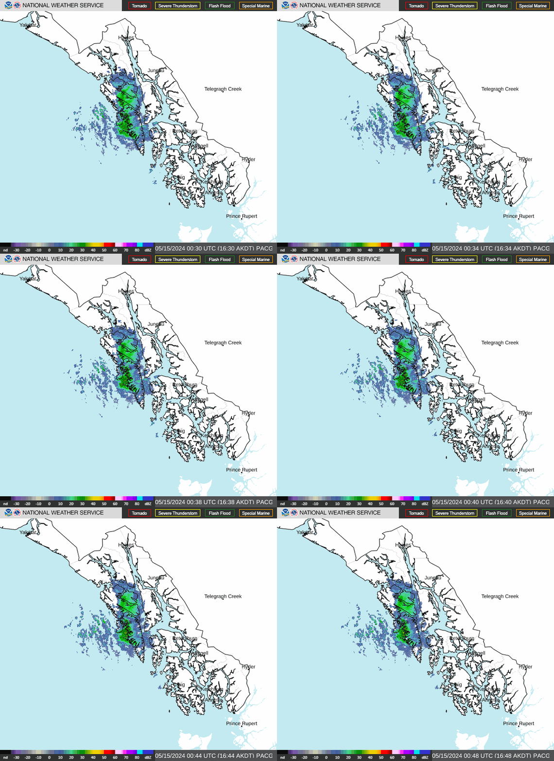
A front continues to progress southeast through the panhandle, with yakutat already clearing out as of 10AM. For the northeast coast some trailing showers behind the front could bring conditions back down to MVFR by this afternoon. For the northern inner channels, moderate to heavy rain will bring significant vis reductions as low as 2sm at times, though rain rates overall should gradually diminish as the front continues southward through the day. Some llws is still expected as the front progresses, primarily for pajn and pags along icy strait. Aside from conditions improving behind the front slightly ahead of previous forecasts, the overall pattern remains unchanged.
...issued at 441 AM akdt wed sep 16 2026...
Synopsis...
Key messages:
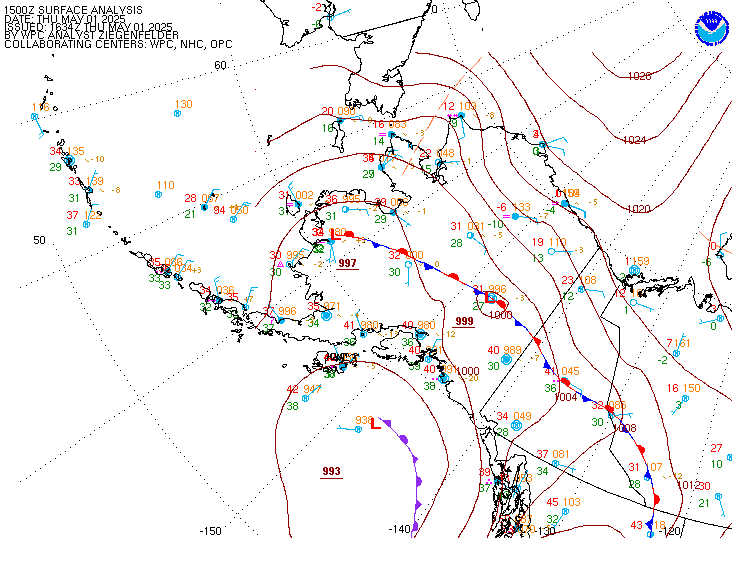
- front swings through the panhandle today, bringing moderate rain and gusty winds. Gales for northern lynn canal and wind advisory for skagway.
- multiple systems to impact the region late week into the weekend, with the potential for heavy rain, gusty winds and increasing seas.
- cooler but seasonable temperatures for the period, with daytime highs generally in the 50S.
Short term.../through thursday night/... Marine layer with widespread stratus has enveloped all of the panhandle overnight as the ridge of high pressure over the southern gets flattened and shifted south and westerly onshore flow increases. Drizzle and spotty light showers are present along the coast and into northern inner channels. A front and atmospheric river are rapidly approaching yakutat, bringing moderate to at times heavy rain through the mid morning. The band of rain will then spread southeast across the panhandle today. Rain rates will diminish as this band shifts south today through the evening. Areas of greatest rain accumulations is for western mountain faces, such as the fairweather range, southern chilkat range, and areas like mendenhall valley in juneau. Could see anywhere between 0.5 to 1.5 inches of rain through this evening. The front will weaken and settle over the southern panhandle tonight. Light onshore flow behind the front will bring chance of light rain or drizzle across central and northern panhandle tonight. For thursday, front will retreat back north across the panhandle later thursday into thursday night as strengthening low pressure lifts northeast into the gulf and approaches the northeast gulf coast by late thursday night, with rain chances rapidly increasing across the panhandle.
Gusty southerly winds across the central and northern panhandle through this evening as the front pushes through. Strong winds for skagway and a wind advisory is in effect for gusts up to 40 MPH. Southeasterly winds will increase thursday night as the low approaches. Cooler, but seasonable temps with highs in the mid to upper 50S, with a few locations in the low 60S across the southern panhandle.
Long term.../friday through wednesday/...upper level features continue to show a rather active pattern through the long range period. We start out with the formation of a broad upper trough stretching from the russian far east to NW canada on friday. The trough is anchored by an upper low moving out of russia late week that eventually positions itself over SW mainland alaska. The broad trough stays in place into early next week, but several short waves are evident rotating around the southern edge of it. There are indications that the trough may break down by mid next week, but there is not much agreement on that scenario yet.
The active weather pattern is still apparent at the surface with a series of fronts expected to move through the region late week, through the weekend, and into early next week. First the low and front that is approaching on friday is still there, but details are still being worked out. The trend so far with it is still setting friday up to be wet (up to 1 to 3 inches of rain fri morning to sat morning) and breezy (winds of 15 to 25 KT for the SE gulf and inside waters) regardless.
The weekend into early next week is looking interesting as well with a strong broad area of low pressure moving into the gulf from the SW and heading toward the northern gulf coast. In addition to the stronger onshore SW flow it will bring, it its wake is a shot of cooler air that will be coming in from the west. Forecast convective indices are already indicating that sunday into monday may be rather convective/showery in nature as the cooler air moves in and the potential is there for some thunderstorms across a large area of the gulf and outer coast at that time. Retained the area of slight chance thunder that was put in yesterday, but also added some areas of chance of thunderstorms along the higher terrain along the outer coast. This system is also looking rather wet and breezy with strong SW to W flow across the gulf into the panhandle and an organized front enhancing the rainfall saturday night into sunday morning.
Damp weather continues into the first half of next week with onshore flow continuing, but showers and W to SW winds will not be as strong. There are indications of more systems moving into the gulf next week, but there is no consensus on when or where yet.
Aviation.../through 12Z thursday/...a low marine layer has moved into much of the panhandle, currently bringing cigs of 3000 to 6000 ft and some areas of lowered vis. A front with associated cigs of 1000 to 3000 ft is also currently moving onshore into yakutat, and will continue eastward over the panhandle today. MVFR conditions will prevail over much of the panhandle through the period, with a drop to IFR conditions from NW to SE as the front passes over. Vis may decrease to 2 to 4 sm with heavier rainfall and low cigs. Onshore winds will increase to 10 to 15 KTS through the northern panhandle this morning, with skagway expected to see gusts up to 40 KTS and haines up to 30 KTS. Wind speeds will decrease through the evening as the system weakens. Based on the frontal band's southwesterly direction, it looks to bring some llws at 25 to 35 KTS to gustavus and juneau. Conditions in the northern panhandle and central outer coast should begin to improve towards the end of the period, thursday night.
Marine... Outside waters: fresh to strong W to SW-ly winds will expand across the gulf this morning as the front shifts eastwards across the panhandle. Winds quickly diminish tonight as the front shifts south and will continue through thursday. Winds begin to increase and become moderate to fresh S to SE-ly thursday night as a strengthening low lifts north into the gulf.
Wave heights building to 8 to 11 ft in the central and northern gulf this morning and remain elevated through this evening, before diminishing overnight down to 4 to 6 ft by thursday. Seas begin to increase late thursday night across the eastern gulf as the low lifts north into the gulf.
Inside channels: predominately fresh to strong southerly winds ahead of approaching front will continue to increase through the morning across the northern and central inner channels. Gales are expected for northern lynn canal and taiya inlet. As the front pushes across, fresh to strong westerly winds expected by late morning within cross sound and icy strait. As this front shifts south and weaken, winds are expected to decrease and become light to gentle across the panhandle, but remain moderate over lynn canal with the tightened gradient. S to SE-ly winds will begin to increase late thursday night as the low pushes into the gulf and front begins to lift back north, becoming fresh to strong by friday afternoon.