Weather Lookup

⚠ Active Alerts

Rip Current Statement Rip Current Statement issued July 28 at 3:01PM EDT until July 31 at 8:00PM EDT by NWS Tampa Bay Ruskin FL

Current Conditions — KTPA

82°F Clear
💧 Humidity 79%
💨 Wind 10 mph SW
👁 Visibility 10.0 mi
🌡 Pressure 29.87 inHg

Hourly Forecast — Tampa,FL

3:00 AM 82°F Isolated Rain Showers 💨 6 mph WSW
4:00 AM 82°F Isolated Rain Showers 💨 7 mph SW
5:00 AM 82°F Scattered Showers And Thunderstorms 💨 7 mph SW
6:00 AM 81°F Scattered Showers And Thunderstorms 💨 8 mph WSW
7:00 AM 81°F Scattered Showers And Thunderstorms 💨 8 mph WSW
8:00 AM 83°F Chance Showers And Thunderstorms 💨 8 mph WSW
9:00 AM 84°F Chance Showers And Thunderstorms 💨 10 mph W
10:00 AM 86°F Scattered Showers And Thunderstorms 💨 10 mph WSW
11:00 AM 87°F Scattered Showers And Thunderstorms 💨 10 mph WSW
12:00 PM 89°F Chance Showers And Thunderstorms 💨 12 mph WSW
1:00 PM 89°F Chance Showers And Thunderstorms 💨 12 mph WSW
2:00 PM 89°F Scattered Showers And Thunderstorms 💨 12 mph WSW
3:00 PM 89°F Scattered Showers And Thunderstorms 💨 13 mph WSW
4:00 PM 90°F Scattered Showers And Thunderstorms 💨 13 mph WSW
5:00 PM 88°F Scattered Showers And Thunderstorms 💨 13 mph WSW
6:00 PM 88°F Scattered Showers And Thunderstorms 💨 13 mph WSW
7:00 PM 87°F Isolated Showers And Thunderstorms 💨 12 mph WSW
8:00 PM 84°F Cloudy 💨 10 mph WSW
9:00 PM 84°F Mostly Cloudy 💨 9 mph WSW
10:00 PM 84°F Mostly Cloudy 💨 9 mph WSW
11:00 PM 84°F Mostly Cloudy 💨 8 mph WSW
12:00 AM 83°F Mostly Cloudy 💨 8 mph WSW
1:00 AM 83°F Isolated Showers And Thunderstorms 💨 8 mph WSW
2:00 AM 83°F Scattered Showers And Thunderstorms 💨 8 mph WSW

Daily Forecast — Tampa,FL

Overnight 81°F Scattered Showers And Thunderstorms 💨 7 mph WSW
Wednesday 93°F Chance Showers And Thunderstorms 💨 8 to 13 mph WSW
Wednesday Night 81°F Scattered Showers And Thunderstorms 💨 8 to 13 mph WSW
Thursday 92°F Scattered Showers And Thunderstorms then Chance Showers And Thunderstorms 💨 9 to 13 mph WSW
Thursday Night 79°F Chance Showers And Thunderstorms then Scattered Showers And Thunderstorms 💨 3 to 10 mph WSW
Friday 89°F Chance Showers And Thunderstorms 💨 7 to 15 mph WSW
Friday Night 79°F Chance Showers And Thunderstorms then Scattered Showers And Thunderstorms 💨 5 to 14 mph WSW
Saturday 92°F Scattered Showers And Thunderstorms then Chance Showers And Thunderstorms 💨 6 to 12 mph WSW
Saturday Night 78°F Chance Showers And Thunderstorms then Scattered Showers And Thunderstorms 💨 6 to 9 mph SW
Sunday 89°F Showers And Thunderstorms 💨 7 to 13 mph SW
Sunday Night 77°F Chance Showers And Thunderstorms 💨 6 to 10 mph SSW
Monday 91°F Scattered Showers And Thunderstorms 💨 9 mph SSW
Monday Night 77°F Scattered Showers And Thunderstorms then Mostly Cloudy 💨 3 to 7 mph SSW
Tuesday 93°F Mostly Sunny then Scattered Showers And Thunderstorms 💨 6 mph SSW

🚗 Road Conditions

Good

Nearest monitored road: Kennedy Boulevard (Primary)

3:45 AM Good
4:00 AM Good
4:15 AM Good
4:30 AM Good
4:45 AM Good
5:00 AM Good
6:00 AM Moderate
7:00 AM Good

Forecast Discussion — TBW

View Full Discussion on NOAA →

Key Messages

- heat impacts remain high to extreme across portions of the nature coast today as feels like temperatures approach 110 degrees.

- increased threat for locally heavy rain thursday through the weekend with potential for localized flooding, especially across the nature coast.

- increasing onshore winds will lead to higher seas across coastal waters and a high risk of rip currents at area beaches for the next several days.

Discussion

Issued at 1243 AM EDT wed jul 29 2026 another hot day across the northern nature coast with high temperatures on wednesday in the mid 90S with heat indices around 110. A frontal boundary will approach north florida late today and will stall across north central florida tonight and thursday. This will increase the areal coverage of showers/thunderstorms across the nature coast with a risk for locally heavy rain beginning late tonight and thursday. It will also act to increase west/southwest boundary layer flow across the forecast area. The increased onshore winds will create a high risk of rip currents along area beaches today through friday.

The frontal boundary will remain quasi-stationary across north central florida on friday, with a reinforcing frontal boundary pushing across the southeast u.S. On saturday, then stalling across north central florida on sunday.

Deep tropical moisture with pcpw values aoa 2 inches will persist for the next several days. Numerous to occasionally widespread showers and thunderstorms will occur each day/night from thursday through sunday...with highest pops north of tampa in the vcnty of the stalled frontal boundary. As daily rainfall totals mount across the nature coast through the weekend, the flood threat will likely increase a bit each day as soil conditions become highly saturated.

Early next week, some drier air aloft may try to work its way over the forecast area which would decrease areal coverage of mainly afternoon showers/storms.

Aviation

(06Z tafs) issued at 1243 AM EDT wed jul 29 2026 predominately VFR conditions through the remainder of the night with sct lcl bkn250 at all terminals. Scattered showers and thunderstorms with lcl MVFR cigs/IFR vsbys will develop over the coastal waters late tonight/early wednesday morning and will advect locally onshore, with the best chance at pie/tpa/srq from about 10-16Z. Scattered showers/storms will develop over the remainder of the coastal counties after sunrise vcnty all terminals from 13-18Z...except lal will likely be delayed a bit due to being inland with timing around 15-20Z.

Marine

Issued at 1243 AM EDT wed jul 29 2026 scattered to numerous showers/thunderstorms will occur each night for the next several days, with areal coverage decreasing during the afternoon hours...except possibly across the northern waters late in the week and over the weekend due to a frontal boundary in the area. Winds will increase to cautionary levels across portions of the waters today, and will remain elevated through the weekend.

Fire Weather

Issued at 1243 AM EDT wed jul 29 2026 no fire weather hazards are expected as sufficient moisture will keep minimum afternoon relative humidity values well above critical levels for the next several days.

Preliminary Point Temps/Pops

Tpa 91 81 90 79 / 60 50 70 60 fmy 92 80 92 79 / 40 20 20 20 gif 94 79 92 77 / 60 50 70 40 srq 91 80 91 79 / 60 50 60 50 bkv 93 78 91 75 / 60 60 70 70 spg 90 82 89 81 / 60 50 70 60

Radar — KTBW

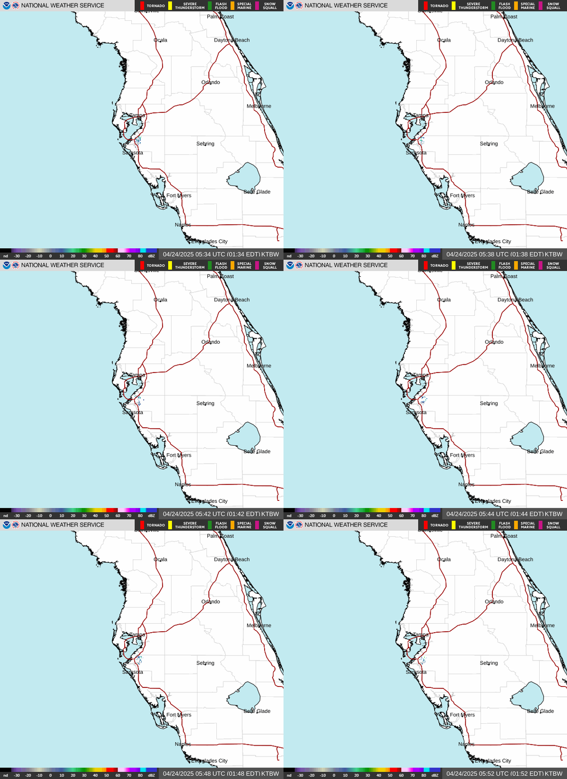
Radar loop for KTBW

Surface Analysis — Eastern U.S. (South)
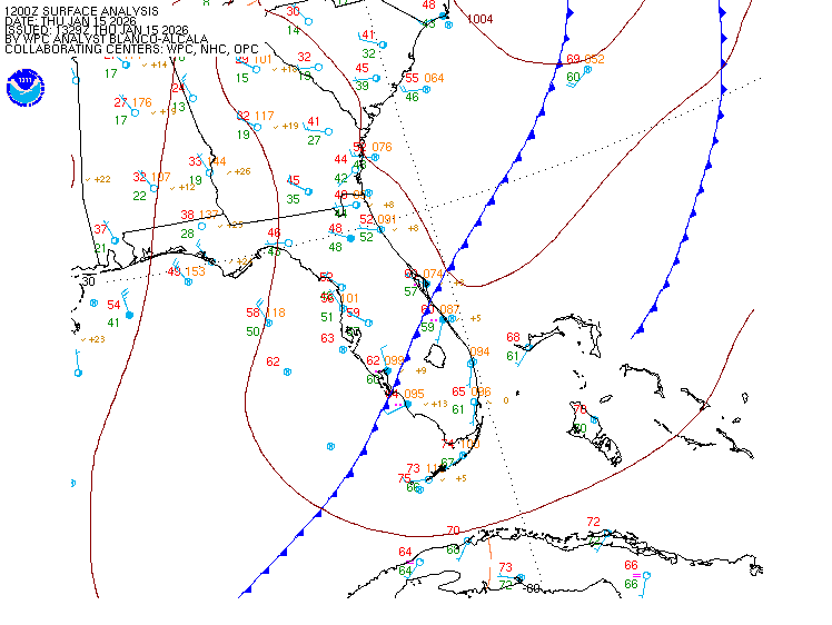
Surface map for Eastern U.S. (South)

Satellite

Satellite imagery
Expanded view