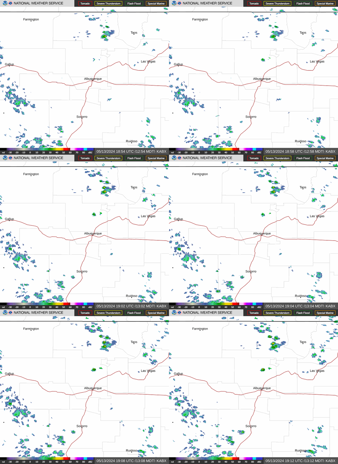
Radar — KABX
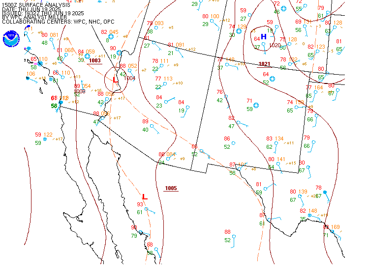
Surface Analysis — Western U.S. (South)
Satellite

Log in to save this location.
Nearest monitored road: US-64 (Primary)
Issued at 956 PM MST sun nov 1 2026 - heavier rainfall will return today through monday morning across western to north central new mexico. Given saturated soils, localized flooding from persistent rainfall will continue in these areas with significant river flooding.
- severe thunderstorms will develop across central and eastern new mexico this afternoon and tonight, bringing a threat for hail, damaging winds and tornadoes.
- a few inches of snow will fall over the northern mountains above 9000 feet monday morning.
(this evening through monday night) issued at 1213 PM MST sun nov 1 2026
Unsettled weather will continue unfolding across northern and central new mexico through the day into tonight and monday. A subtropical shortwave is racing northeastward via the subtropical jet, moving into az and slated to move into north central nm through the early evening. This continues to bring up anomalously moist conditions with this morning's 12Z raob showing a PWAT of 1.08, shattering the previous daily record by more than two tenths of an inch. This does have to be put into context though, as pwats this time of year are not typically as high as during the monsoon. That being said, this is setting up a significant precipitation event, especially for northwestern to north central areas of nm where there are still saturated soils and river flooding recoveries ongoing. A separate deep and vast pacific low pressure system is also moving out of ca and into nv, producing strong upward forcing into az and nm. Model projections take the large ongoing swath of stratiform rain over az and western nm and evolve it into a convective line oriented north northeast to south southwest this afternoon as instability increases. The line of storms will work over the continental divide this afternoon, moving into the rio grande valley and overtaking the central mountain chain by early evening. The line is then projected to move into the eastern plains late this evening and out of nm through the very early morning hours.
The rap analysis is already showing 500 j/kg of mlcape in the rio grande valley, and these values climb through the afternoon, this will help fuel strong to severe cells within the qlcs with plenty of deep layer speed SHEAR (40-60 KT in 0-6 km layer) and healthy 0-3 km helicity (150-250m2/S2) to keep a tornado risk with the line.
As for hydrology concerns, the flood watch remains out through noon monday, and a few river flood warnings have already been issued for north central to northwestern nm. Again, saturated soils and swollen rivers in northwestern to north central nm will remain of high concern through and perhaps beyond this time with additional rainfall amounts ranging from 0.5 in in the san juan valley upwards of 2.5 inches in the san juans and tusas mountains of co/nm which will produce longer duration runoff beyond the immediate shorter duration downpours received through this evening.
Not to be forgotten, but winds will also pose impacts with prevailing gusts of 35 to 50 MPH being common through the afternoon. The wind advisory was expanded in the northeastern highlands near the i-25 corridor (raton to las vegas), and a high wind warning has also been issued for the sacramento mountains which may encroach upon gusts of 50-60 MPH for later tonight into early monday. Convective outflows and downbursts will also pose wind concerns with gusts of 60+ MPH within reach from the qlcs through the evening.
Into the day monday, precipitation will have mostly waned in eastern nm with spotty coverage in central areas while the focus will have shifted to north central areas due to wrap-around dynamics associated with the upper low. The cold upper low and pacific front will have swept through before daybreak monday, causing rain to changeover to snow in higher elevations. Snow accumulations look to mostly be confined to 9,000-10,000 ft and higher where 1 to 6 inches seem reasonable. Another slew of wind advisories will also likely be needed for the central highlands into the eastern plains, including the i-40 corridor east of clines corners. Precipitation will taper off from west to east monday evening as the low exits eastward, but winds will remain brisk in the far northeast corner of nm overnight.
(tuesday through saturday) issued at 1213 PM MST sun nov 1 2026
The pattern turns considerably more tranquil into tuesday with lighter and drier northwest flow aloft prevailing. Skies will turn clear through the late morning with batches of high cirrus filling in later in the day. Surface breezes will be much more subdued, and temperatures will run just a couple to a few degrees below early november climatology.
We continue to assess model solutions and their depiction of a closed low that moves inland off of the pacific and crosses the great basin into the central rockies by wednesday. This feature does look to host some baroclinicity with its 90-100 KT jet streak rounding its base, but overall precipitation looks to remain confined within the core of the low due to weaker and unestablished dynamics aloft. This would keep most of the precipitation in ut and co, with just isolated to scattered pops for our northern nm zones through wednesday night. Guidance does not advertise very strong winds for wednesday, but this will need to be monitored, as upper level momentum will be increasing.
Slightly cooler air would filter into nm on the backside of this departing low by thursday. Daytime temperatures would still run near to just slightly below normal on thursday with light to moderate breezes prevailing.
Dry west northwest flow looks to prevail into friday and saturday with a weak perturbation meandering nearby, but posing no threat for precipitation. Another wave of cooler air will filter in on saturday as another low drops into the central plains, but again daytime highs will stay near to only slightly below normal. A building ridge early next week would suggest slightly warmer readings with tranquility persisting.
(06Z tafs) issued at 956 PM MST sun nov 1 2026
Another round of potential storm development is in store across southern new mexico which will impact krow from 06-08Z . Erratic, gusty winds with reduced visibilities are going to be the main impacts if a storm develops near the terminal. Elsewhere, an additional round of rain looks to occur across portions of northwestern and central new mexico late this evening into the early morning hours. Cigs are mainly expected to remain above 3000 ft, though brief lowering in cigs may occur with periods of moderate to heavier rainfall. Southerly winds will shift southwesterly to westerly and become breezy during the morning at most terminals.
Issued at 1213 PM MST sun nov 1 2026
Widespread rain is overtaking far western nm into north central portions of the state where soggy soils and fuels will persist along with a threat of long duration flooding through tonight, monday, and tuesday. Elsewhere rainfall amounts will be of shorter duration, but still scattered to widespread as a north-south oriented line of storms sweeps eastward through the afternoon and evening. In the wake of these storms, additional waves of lighter rain and mountain snow will redevelop over northwestern to north central nm late tonight into monday. Excellent humidity recovery will develop tonight through monday morning. Wind concerns will exist, mainly today and monday with southerly winds this afternoon transitioning more westerly this evening behind a pacific front, gradually turning more northwesterly into monday when gusts of 35 to 55 MPH will be common. Highest gusts on monday will be in the eastern half of the state, but fortunately humidity will be elevated and fuels moist enough to prevent critical fire weather concerns. Other than a few showers in northern zones on wednesday and a couple of bouts of slightly, and nearly negligibly, cooler air on thursday and saturday, there are not many noteworthy impacts looming ahead for the rest of this week.