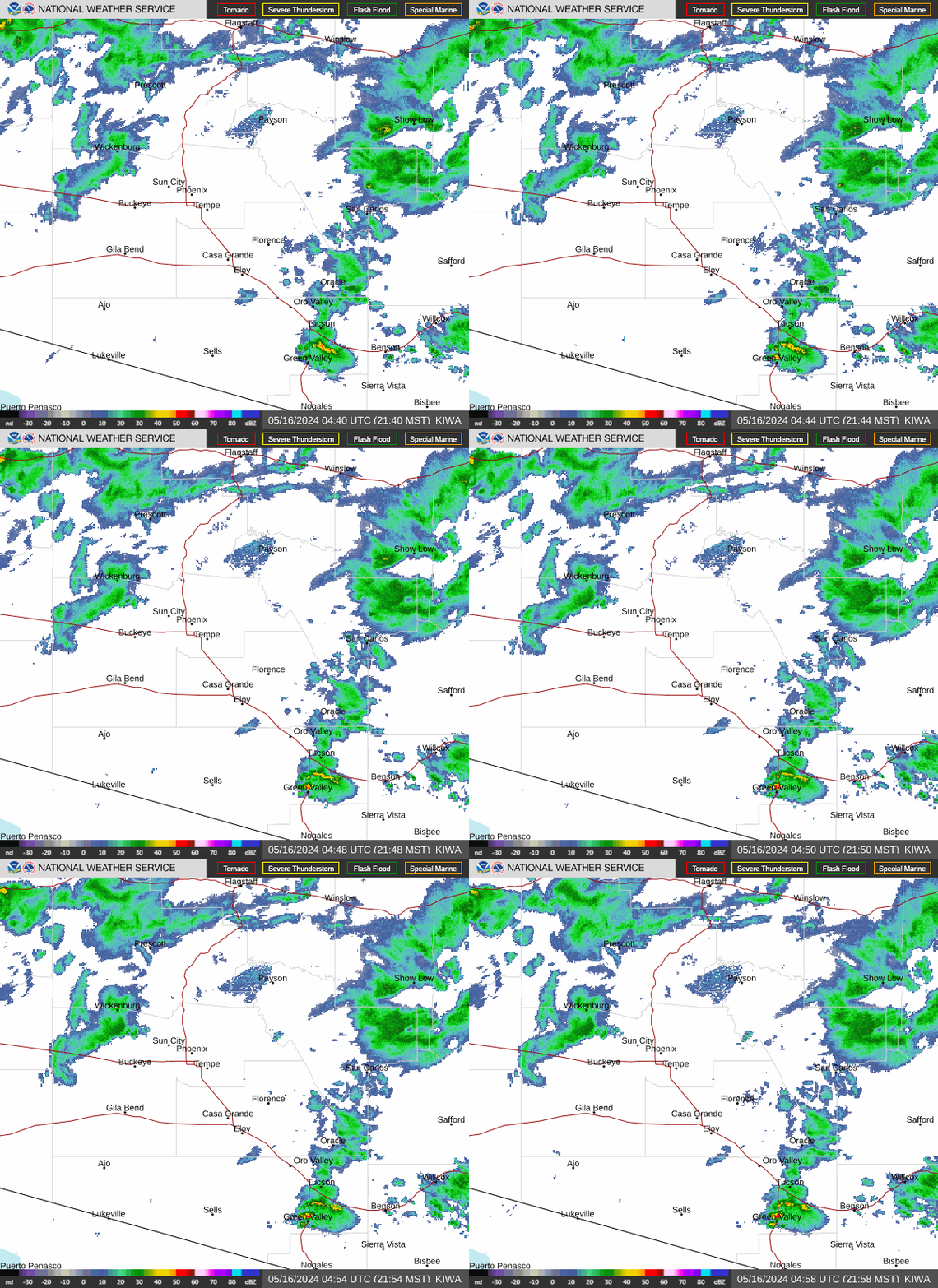
Radar — KIWA
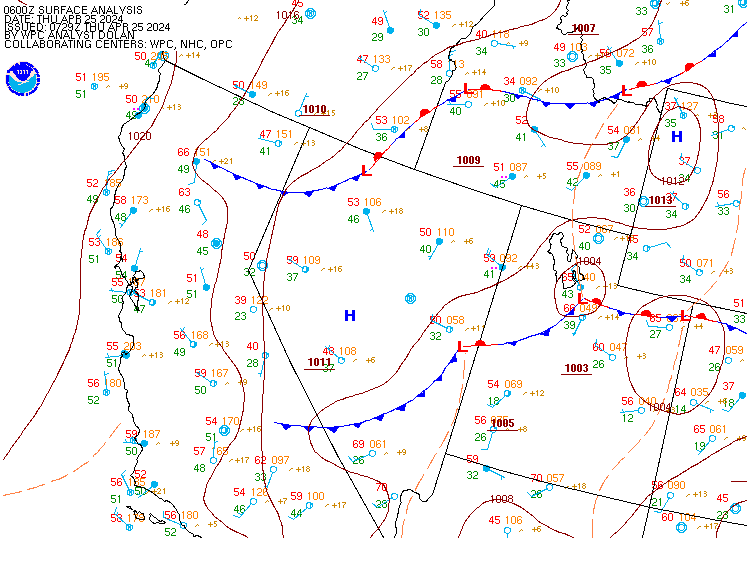
Surface Analysis — Western U.S. (Central)
Satellite

Log in to save this location.
Nearest monitored road: East Apache Boulevard (Primary)
- scattered to widespread showers and storms are forecast to continue today across arizona, with areas of high rainfall amounts leading to flash flooding.
- a flood watch remains in effect through early tonight across much of southern arizona.
- shower and thunderstorm chances will greatly diminish by thursday and come to an end starting friday with much drier air moving in and lasting through at least this weekend.
- below normal temperatures are expected today across south- central arizona, before warming back to to slightly above normal levels by the weekend.
Rap40 500mb height analysis shows broad troughing over western conus, with the low centered over northern california, and ridging over the southern gulf states. This places the desert SW sandwiched between these two larger features, keeping flow aloft mostly out of the south-southwest, advecting moisture into the region from northern mexico. More impactful, a well defined low pressure circulation is seen on satellite along the west coast of sonora, mx. This feature is forecasted to continue moving straight north up through az likely this afternoon through tonight and help provide the lift that has been somewhat lacking. The atmosphere is primed with ample moisture, with 1000-700mb mixing ratios from this morning's 12Z sounding at 14 g/kg and pwats at 1.90", upwards of 200% of normal. With this moisture in place the lift from the previously mentioned low will be be strengthened by the upper level jet to the region's north providing extra support. Models are forecasting mucape to be generally between 1500-2000 j/kg this afternoon, however, some models are showing support for upwards of 2500 j/kg, with CIN below -100 j/kg. With any decent lift, this would make for a favorable environment for storms to develop and continue, possible even training leading to heavy rainfall, especially this afternoon and into the later evening hours.
A flood watch is currently in effect for south-central az and will continue through 11 PM MST tonight. The watch was issued largely due to the synoptic and mesoscale setup being supportive of scattered to widespread showers and storms capable of producing 1-hr rain rates up around 1-2" and higher over shorter time frames, especially in the eastern high terrain. So far this morning, localized areas in the eastern phoenix, the northern foothills and eastern high terrain have received between 1.5"-2.75". Hi-res modeling continues to show additional QPF upwards of 1-2.5" over a large portion of south- central az, and there are even high end amounts up to around 3"-4", although chances are limited, and isolated in nature. With everything coming together and starting to develop as we head into the afternoon hours WPC day 1 ero guidance remains as a moderate risk for all of gila county and most of maricopa county. A slight ero risk remains from far western maricopa and westwards near to az/ca state border. The last time a moderate risk covered this area was back in 2022.
Today will be the peak of the activity as the low circulation will move north of the area by late tonight, but a narrow axis of showers and storms may linger into the overnight hours, most likely toward eastern az. Once the system fully exits the region the environment will be too overworked, and subsidence increases on the back side of the low. This will result in drier air beginning to advent into the reign with west to southwesterly flow aloft. These conditions will limit showers and storms mostly to northern az high terrain on thursday, fallowed by further drying by friday, limiting showers across even the higher terrain, and 1000-700 mb mixing ratios drop to 8 g/kg or below, and pwats will also decrease to sub 1.00".
Temperatures this afternoon may struggle to reach 90 degrees across south-central az, with ample cloud cover and rain around, while areas further west, with more sun, still warm into the middle 90S to around 100 degrees. Temperatures will warm back up by the end of the week, but only back to around seasonal levels, with highs around 100 degrees across the lower deserts, as broad troughing remain in place across much of the west.
The monsoon pattern may be done after today, shifting into the transitional season with more frequent troughs. Dry air will continue to spread across the region through this weekend with pwats forecast to drop below normal, as low as 0.4-0.7" across the lower deserts. The will inhibit any chance at rain. The broad trough moving through the west, helping drive the westerly flow and dry air, is expected to shift east into the plains by the start of next week. Global ensemble guidance then shows an upper low moving out of the pacific toward the socal coast by the end of the day monday. There is still plenty of uncertainty regarding this low this far out, but it may be what helps eventually drive moisture back up in the deserts and drive the next chance at rain. Average to slightly above average temperatures are forecast this weekend through the first half of next week with this forecast, with afternoon highs around to slightly above 100 degrees. With the drier air coming in, the morning lows will finally be more pleasant, consistently dropping into the 70S for most lower desert locations.
Updated at 1615Z.
South central arizona including kphx, kiwa, ksdl, and kdvt: forecast continues to remain on track with major operational impacts likely this afternoon through this evening. Clusters of thunderstorms are expected to develop within the vicinity in the next couple of hours with the current guidance indicating the highest direct impacts likely by the mid to late afternoon hours and possibly lingering into the evening hours. Overall wind direction should remain out of the southeast before activity materializes with the potential for gusty and erratic winds as thunderstorm activity increases in coverage within the vicinity. For most of the period, winds should generally maintain an easterly component.
In addition to direct thunderstorm impacts, instances of MVFR and possibly brief IFR flight categories are possible in the form of lowered cigs (as low as 4-5 kft with tsra) and visibilities. Shra activity will likely linger well into the evening and overnight hours with lower probabilities of tsra and thus have maintained a prob30 mention for this evening for tsra as there is high uncertainty. Vcsh look to linger through 10-12Z thursday morning with bkn cigs between 5-7 kft looking to linger before scattering out by the mid to late morning hours.
Southeast california/southwest arizona including kipl and kblh: no major weather issues will exist through the taf period under mostly clear skies, with few low (aoa 7-9 kft) and high clouds moving in at the end of the taf period. At kipl, winds will generally be out of the southeast with some gusts into the mid to upper teens later this afternoon through early this evening. At kblh, southerly winds are expected through the afternoon with periodic gusts between 20-25 KTS. There continues to be increasing confidence that an outflow from the convective complex in az will likely affect kblh by the early evening hours, shifting the winds more out of the east with potentially some gusts between 20-25 KTS and maybe some reduced visibilities due to some bldu, although confidence of bldu materializing is low at this time. Winds across both terminal sites should become mostly light and variable during the overnight and early morning hours.
Periods of scattered to widespread showers and thunderstorms are expected to continue today, focusing mostly across the eastern districts this afternoon through this evening, however widespread activity over much of the lower deserts can be expected. There will be a heavy rainfall and flood threat with the activity. Moisture levels will be elevated most areas, highest across eastern districts, where minimum rh this afternoon will be around 50-60%. Minimum rhs will be lowest across southeast ca, with values around 20-30%. A drying trend will begin thursday with conditions becoming very dry by this weekend. Minimum rhs by saturday dip to 10-25% across the lower deserts (lowest across western districts). Overnight recoveries will still be good across eastern districts this weekend at 40-60%, while western districts hover around 25-45%. The drier air moving in will eliminate rain chances by friday, with low chances in gila county thursday afternoon. Winds will favor the south to southeast over much of the area through wednesday with gusts of 20-30 MPH at times across southwest az and southeast ca. In the following days winds will return to a more typical diurnal with modest afternoon upslope gustiness.